Showing posts with label Amazing Earth. Show all posts

Mt. Talamitam: Bonding with the guides

0 comments

Christian flashed a shy smile as I approached the bench he was sitting on, his feet propped up on the unpolished wood on either side of him. I was being shielded from the drizzle by my brown umbrella which I folded upon coming under the shed that was part of the registration area.

DSC_0404b

It was already past 3 PM, and I needed at least 2 hours to climb the summit, pause for a while, and climb back down. I had to be back at the highway by 7 PM in time for the last trip of the bus that would take me back to Manila.

“Samahan mo ulit ako,” I told Christian, talking about being my guide once again just like a year ago.

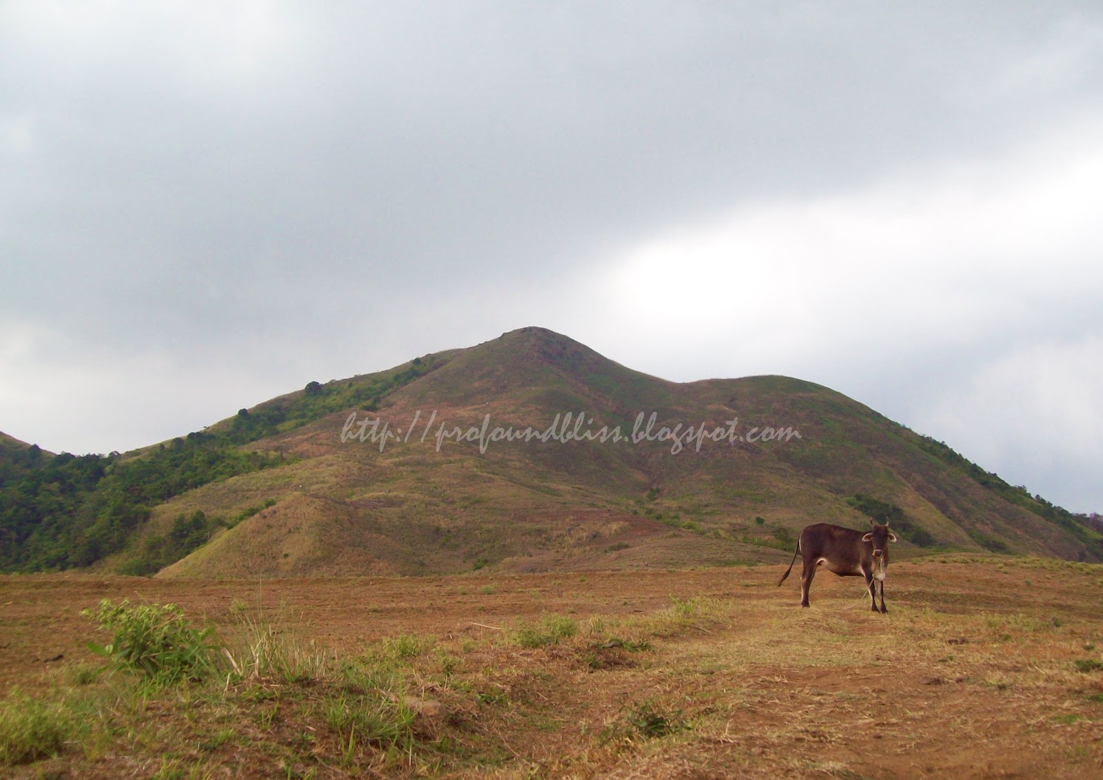
That Mt. Talamitam climb in the summer of 2011 was one of my most unforgettable climbs. While it was scorching hot when we started the hike, we had to pause and hide under the leaves of banana trees when it suddenly rained; the lightning and thunderstorm made it so scary for us to go on. The mountain, by the way, was the most barren that I have climbed.

The kid, who was now more certain that it was indeed me from last year, said, “Ang hilig mo sa naulan at saka sa hapon.” (You’re so fond of climbing when it rains and in the afternoon.) It was 2 PM when we climbed last year.

Meawhile, one of Christian’s two cousins who went with us last year was also there. Floriel greeted me excitedly and started talking about the pancit canton we cooked with rainwater at the summit and how we were afraid of getting struck by lightning.

After writing my name on the log book, changing into my climbing clothes and leaving most of my stuff in Bro. Ted’s (the Barangay Chairman and the kids’ uncle) house, Christian, Floriel and I walked under the drizzle and headed for the summit.

It was a tiring climb for me because I have been climbing rarely these days. Sitting in front of the computer all day with no exercise whatsoever has taken a toll on me. I asked to rest three times all through the climb but we were still able to make it to the summit in an hour and twenty.

The talks I shared with Christian and Floriel along the way made the climb seem faster than it actually was. I don’t know if it was just a feeling, but they treated me like a long lost friend, filling me in on the highlights of their young lives since we last saw one another. It also became like a funny interview when the conversation turned on me, as I tried to answer them in ways their young minds could grasp.

Floriel and Christian at the summit

I had with me the DSLR, but because it was drizzling (and I left the umbrella back at Bro. Ted’s, of course) I was only able to take a few shots at the summit. It was also getting late so I had to hurry back.

Using the side trail on our way back, we passed by some mountaineers (thirteen, according to Floriel) camped just below the summit. They were going to stay overnight and it was so brave of them to do so despite the drizzle, strong winds and dark clouds that threatened hard rains.

At exactly 5:50 PM, we were already at the lone store near the registration where we had ham and egg sandwiches and sodas. I needed that because I would be in for a long ride back to Manila.

Floriel, Christian and Florian

The light and bubbly conversation continued on while we ate, and while at it, Florian, Floriel’s younger brother who also climbed with me last year, arrived. He was less shy now, and he showed the most physical change when I last saw them. He’s now taller and more conscious of his looks. (Compare the above photo with this.)

He was all smiles and joined the other boys in telling me stories – mostly about school, girls, and some scary stuff.

Time flew by so fast, though, and I had to go. The three of them walked me to the highway and stayed with me while I waited for the bus.

“Kailan ulit balik mo, Kuya?” Christian asked, and I was glad he dropped the “Sir” for “Kuya.”

“’Pag may time, babalik ako,” I promised.

Floriel, being the only one who had a cellphone, even gave me his number. “Text mo kami, ha, Kuya?”

I know I have created a bond with the kids. I haven’t texted them yet, but I will one of these days.

Somehow, I now know that it’s really not the mountain that gives you great experiences but how you climb it and the experiences and friends that you gain while walking its trails.

Mt. Talamitam has indeed given me memorable experiences in the two times I climbed the mountain. The first one may be most remembered by the hard rain and thunderstorms, but I know the second one will always put a smile on my face every time it will cross my mind.

Day Hiking (Hidden) Buntot Palos Falls

0 comments

It was supposed to be just plain mountain climbing but K, my climb buddy, wanted to go "chasing waterfalls" so we went to Buntot Palos (or Hidden Falls, as what the falls is known to the locals) last Sunday, July 24, 2011.

139_0018

We didn't get a guide anymore cuz we heard the trail was pretty easy to follow. You just have to lookout for this flat rock in the middle of the trail right after passing the second stream (sapa). A little before that rock is the almost invisible trail to the left that goes down to the campsite.

Once you reach the campsite, there's another trail to the left that leads down to the falls area. It was very steep, reminiscent of the steep trail that leads down to Buruwisan Falls. But K seemed to find the descent so easy. I took a video of him at one point.

You have to cross the water in order to get near the falls. The rocks were quite close together but there's this one hop I had to make that I couldn't do. The rock was inclined and a little far from the one I had to hop from and the surface was wet and looked so slippery. I couldn't really trust even the Merrell Barefoot I was wearing with my life. LoL! I was afraid of slipping and falling and getting carried away by the strong current of water. Look at where I stopped in the video and how K laughed.

The Buntot Palos falls was grandiose! It looked even more beautiful than Buruwisan Falls in Mt. Romelo. It has a 40-meter drop that breaks into large rocks forming small cascades before flowing into the deep catch basin. The water was cold, but not as cold as the water of Taytay Falls, making it ideal for swimming. K and I even killed some time in the water with the other four climbers that day together with some kids from Brgy. Balian who was there to bond.

One of the kids named Ronnel took this:

139_0026

We pitched the tent so we could have a place to leave our stuff while we swim. That, in the picture, was my P550 two-person tent I bought on mark down at Ace Hardware. It's not something sturdy that can shield you from the rain or strong winds, though. It's just good for purposes like a place to change clothes or leave your stuff.

But it was so hot we had lunch under the tress at the mountainside. There's a big, broken pvc pipe at that part and the guide of the other group told me the water coming out of it is potable. True enough, I drank from the refreshingly cold supply and my sensitive stomach didn't as much as get upset. I also cooked my pancit canton using it.

Buntot Palos Falls, which the locals call Hidden Falls, is now in my favorite trips list. Not so strenuous like a real mountain climb, the place was serene and the beauty of the waterfall was really captivating. It's also not so expensive to go to. An ordinary bus ride from Alabang to Sta. Cruz only cost P80. From there, a jeep to Siniloan was P36 and the tricycle ride to Brgy. Balian was only P80 per trip (but we were only charged P70 by a different driver on our way back).

I'd like to commend K for choosing Buntot Palos as our destination yesterday. It was a spur-of-the-moment plan but ended up one of our best hikes together.

139_0029

Take a look at my Buntot Palos Falls photoset by clicking this link. You can likewise follow me on Facebook and Twitter.

How to get to Buntot Palos Falls:

- ride a Sta. Cruz, Laguna-bound bus and get off at the terminal (P80)
- from the bus terminal in Sta. Cruz, ride a Siniloan-bound jeepney; ask to be dropped of in front of Jollibee or Sts. Peter & Paul Parish Church (P36)
- Hire a tricycle to take you to Buntot Palos Waterfalls (or Hidden Falls) jump-off in Brgy. Balian. (P80)
- at the jump-off, someone with a logbook will approach you, register and pay for the registration (P25)
- if you don't want to get a guide, just follow the cement road, it will soon end and you'll find yourself in a dirt road and eventually the mountain trail
- look for the barely visible path to the left between the second stream and the stone in the middle of the trail
- once at the campsite, descend to the waterfalls using the trail to the left (be careful for the trail is very steep)

Underwater Volcanoes Near Antarctica Discovered

0 comments

Nature's surprises doesn't seem to end. It really doesn't stop with the climate change, because we discover more about the earth as time goes by.

Imagine discovering a string of underwater volcanoes near Antarctica rising up to 3,000 meters above the ocean floor just recently?

Read more about them volcanoes here.

7.1-Magnitude Earthquake Hit Japan's Northeastern Coast, July 10, 2011

0 comments

A tsunami warning was again prompted for the Northeastern coastal part of Japan as a 7.1-magnitude earthquake hit that part of the country on Sunday morning July 10, 2011, around 9:57 AM.

It was the same area devastated by tsunami last March 11 when an 8.9-magnitude earthquake hit the coastal area.

Residents were advised to evacuate as the 7.1-magnitude quake felt earlier could generate a tsunami.

They surely wouldn't want the March 11 tragedy to repeat itself.

Getting Lost in Mt. Kalisungan

0 comments

Before my climb buddy started school last month, we decided to climb again. Dayhike destinations are already becoming rare, though, cuz we have already climbed the ones near Manila. If we could avoid it, though, we really wouldn't go to Mt. Kalisungan without a group. Holdups and getting lost stories in the jump off were so all over the internet and could we avoid that place, we would choose a different destination.

But we couldn't.

136_2020

So last June 8, 2011, K and I braved the bad weather and went to Calauan, Laguna to climb Mt. Kalisungan. We boarded a Sta. Cruz-bound bus in Alabang and told the conductor to drop us off at the Duck Junction in Victoria, Laguna. He said okay so all the while, we thought he knew where the place is. Good thing that at one point, K decided to ask him again if we're still far from the Duck Junction. A man sitting across the aisle overheard us and said we're already past the said junction. It was only then that the conductor said he knew Victoria but didn't know exactly where the Duck Junction was. Okay so he was planning to drop us off at the boundary of Victoria and the next town? Good grief!

We got off the bus and stopped a passing trike. The trike driver knew where the Duck Junction was and even agreed to take us to Barangay Lamot 2. There are actually two jump-offs you can choose from to climb up Mt. Kalisungan: Erais Farm and Field of Faith Sanctuary. Erais Farm has a very established but steeper trail, while Field of Faith has "forky" but moderate trail.

It would be rational to think that first timers on this mountain who wouldn't want to shell out cash for a guide would choose Erais Farm. But mind you, there's an infamous ex-convict residing there, well-known for terrifying climbers (or so the internet says). There are also stories of hold-ups in Erais that's why we shied away from using that jump-off.

So we chose the "forky trail" of Field of Faith Sanctuary located in Barangay Lamot 2. We'd rather get lost (at least you could retrace your way back) than give our stuff to "charity."

The barangay hall/registration area of Barangay Lamot 2 is just in front of the cement road leading to Faith Chapel. There was no registration fee but they would ask for donations. No one in there, though, could give us any idea at where to turn at the road fork.

field of faith sanctuary

We thought only common sense would be enough to lead us to the right trail but we were amazed at how the trail split. First one was at the end of the cement road, which was in front of the Faith Chapel, where we were faced with three paths. We saw a gardener who was probably in his early twenties, and asked about which path we should take for Mt. Kalisungan. He pointed us to the right and we gladly thanked him. The trail split again into three after a while, and to three again after quite sometime.

We ended up in a house full of kids who called their Lola when we started asking. The lola, though, didn't know about the mountain we were talking about even if we showed her the pictures we printed out from the internet. She pointed us to another house which was so far from hers, and likewise, people from that other house didn't even know where Mt. Kalisungan was. We dropped names like Mt. Kalisungan, Mt. Calauan, and Mt. Nagcarlan – the alternative names of the mountain according to Pinoy Mountaineer – but they were clueless and looked at us like we were crazy for wanting to climb up a mountain on a rainy day.

You see, it rained the minute we left the barangay hall. I had no poncho cuz I gave it to Christian (my little guide in Mt. Talamitam) and Ace Hardware ran out-of-stock of ponchos when I went there the previous night. K, though, had on his jacket which he thought was waterproof but was actually not, he ended up using his big yellow raincoat when he realized he's getting wet to the skin.

A teenager from the second house pointed us to a trail that would lead us to another house where we could ask. At that point, we were already thinking of retracing our steps to take a different trail from the first fork at the end of the cement road, but decided to go to the third house first. And it was a good thing because the old couple living there knew the mountain we're talking about.

The old man, perhaps in his late 60s (I'm no good at telling age but he really looked old), whose name was Ben, looked at the pictures we brought. He said that the picture from Pinoy Mountaineer labeled Mt. Kalisungan and the summit picture didn't go together. According to him, the labeled picture was a mountain they own, and the summit picture belong to the other mountain in the opposite side.

But the most important thing was, Tatay Ben (short for Benigno) decided to bring us to the point of the trail where we "wouldn't get lost" anymore. I was so amazed at how Tatay Ben still walked so fast despite his old age. I silently wished I'd be as strong as he when I get old. The old man wouldn't accept anything from us. Not money, not sandwiches. He said he was only happy to help, and we're the second lost mountaineers he encountered. We couldn't thank him enough for his kindness.

The wind and rain got harder as we went higher up Mt. Kalisungan. I had to put my cameras inside a Ziploc to keep them dry. And that was the second time I wished I had a waterproof camera (the first one was when it rained while I was watching the Pasayahan sa Lucena parade).

k after lunch

It was 12:30 PM when we reached this big tree and decided to stop by for lunch. The tree's leaves and branches somehow shielded us from the rain. I had sandwiches and pouched pork and beans while K still had to cook his pancit canton. None of us brought rice cuz it's really heavy on the bag. We also took that time to call home using my PLDT Landline Plus that has been so useful when I go out-of-town.

We only remained there for half an hour and carried on with the hike. The trail still split numerous times. We ended up in a kaingin at one point so we went back to the last fork and went the other way. We were already so high up when we stumbled into a sloped clearing that looked like another kaingin with no crops. Beyond the clearing was a wall of cogon grass that had no opening. We wouldn't wanna go back again because that would mean going two road forks back. We just decided to go through the cogon wall and make our own way.

It wasn't an easy task, what with the strong wind and rain making our ordeal with the taller-than-us cogon more difficult. After about 30 minutes of finding our way through the field of sharp-edged grasses, we caught sight of the summit. Soon after that, we stumbled upon the main trail going up. We almost shouted with relief.

K almost gave up before we found the right trail. More than once did he talk about going back. But I couldn't show negativity when my buddy showed it first so even if I felt like going back myself, I kept on telling K that we're on the right track (while making our own trail through the field of cogon grass LoL!).

But, at least, our efforts paid off.

The white cross near the summit was still standing while we were approaching. But as soon as we got near it, the cross gave to the force of the wind.

We stopped for a while to take some pics and to admire the beauty of the 360-degree view of Laguna and nearby towns. The seven lakes of San Pablo were really visible. But remaining inactive in the middle of strong wind and rain made us shiver. It was really cold!

We immediately went to the summit so we could finish it off and head back. We summited Mt. Kalisungan at 3:20 PM of June 8, 2011. A piece of wood sticking up from the ground was what remained of the wooden cross at the summit. The wood was adorned with a piece of worn-out black shirt (probably from a fellow mountaineer). We took pictures by the wood just the same.

k and i

Aside from the seven lakes of San Pablo, Mt. Makiling was also visible from the summit as well as Mt. Cristobal and Mt. Banahaw.

Having not climbed Mt. Makiling yet, K had his pic taken with Mt. Makiling in the background. LoL!

We headed back down after the photo-op. We were already midway down when I realized we didn't have a pic at the summit together. Rough weather really make you forget about things. Oh well, it was too late to go back and we were in a hurry not to let the dark catch us in the mountain.

It was a very smooth descent since we used the Erais Farm trail. We would have wanted to drop by Tatay Ben's place on our way down but we couldn't find the trail we used in going up anymore. Well, that's unless we go through the cogon field again. But that's already insane.

We had this sort of fear of Erais Farm due to what we read on the internet. And somehow, the meanness of the place was confirmed when while walking the tree-lined path of the farm, a man going our way eyed us like he's mad. We greeted the usual magandang hapon but he just eyed us like we're some sort of unwanted persons around.

erais farm

Oh well, that's what you get when you pass through a private property unannounced.

People of Lamot should really develop the trail at the Field of Faith Sanctuary (and please make directional signs like the ones in Pico de Loro). After all, that's where the barangay hall/registration area is. I'm sure more mountaineers would frequent Mt. Kalisungan if (1) the trails are established you won't need a guide anymore; and (2) there are no more encounter with mean individuals and hold-up at the jump-off stories being told.

Click here for more of our Mt. Kalisungan photos.

How to get to Mt. Kalisungan:

- ride a Sta. Cruz, Laguna-bound bus and drop off at the Duck Junction in Victoria (*P91)
- hire a trike to take you to the barangay hall of Barangay Lamot 2 or, if you brave it, to Erais Farm (*P15)
- register at barangay hall. no fixed reg fee but they ask for donations; you can also ask the officials for a guide if you want one

* fare prices indicated are as of June 2011

136_2021

Below is a collection of videos I took during our Mt. Kalisungan climb:

Don't forget to follow Profound Bliss on Facebok and Twitter.

A Rainy Mt. Talamitam Climb

0 comments

Longing for a solitary climb, I searched the internet for a dayhike destination near Manila - a mountain that would be accessible, not exceeding 800 MASL, and that I haven't climbed before.

136_1732

I couldn't find any other mountain that fit those classifications than Mt. Talamitan in Nasugbu, Batangas. With an elevation of 630+ MASL and with a jump-off just along the Tagaytay-Nasugbu Highway, Mt. Talamitan is a friendly one for someone without a company. And although there are talks about how two parties "battle" for the "management" of the mountain, I didn't really care. I've been going around long enough to know that internet articles could be so exaggerated than the actual situation itself.

I woke up a little late that Thursday morning of April 28th. Perhaps knowing that it's fun climb made me underestimate the climb. I was at the Alabang Bus Terminal by 9:00 AM, forgetting there's no Nasugbu-bound buses there. But, of course, I knew there's always a way. A driver approached me and asked where I was headed. He told me that I should hop on his Batangas City-bound bus and he'd drop me off at the diversion road. From there I could ride another bus going to Nasugbu. I was so clueless without a map, but I asked if that was the only alternative and he said yes.

Okay, so much for being fooled but I was able to reach the diversion road, got on a Nasugbu-bound bus, dropped at Palico, and rode another jeepney headed to Nasugbu town that would pass by the jump-off in Sitio Bayabasan.

But it was almost 2 PM that time. I immediately asked around for Sir Nick or Bro. Ted's house. People looked quizzically at me since I was alone and in climbing clothes. That, or because they didn't know whose house to give me directions to. One man gave me directions to Bro. Ted's house, and while walking, I saw an old woman coming from a sari-sari store and heading towards the direction I was headed. I asked for Bro. Ted's house and to my surprise, she shook her head as if I had asked her a question she didn't wanna hear. Anyway, she walked so fast and in the distance, I saw her stopped by a fence and talked to someone. She was still there while I passed. She looked at me and the man inside the fence as if the two were talking about me.

I had a hunch it was Sir Nick inside the fence, and that hunch was confirmed when I was able to talk to Bro. Ted after my climb.

Anyway, I reached Bro. Ted's house (which was actually his mom's house). It serves as registration area, at least to those who choose him over Sir Nick. But in all honesty, I didn't choose anyone. I knew about the dispute but since I didn't really know them personally, either of them would have been okay. It's just that people seemed more willing to give directions to Bro. Ted's house.

registration

I arrived at the place, which you wouldn't miss because of big signs, and asked for Bro. Ted. He wasn't there unfortunately and I was greeted instead by his brother Sir Paul, and his mother Ma'am Nelia. They were quite friendly and accommodating. I found out that I was the only mountaineer who arrived that day, perhaps because it's a Thursday and there's actually a Low Pressure Area threatening hard rain.

I asked for a guide and they gave me a kid named Christian. Two of Christian's cousins, though, joined us. They're from Bicol and were only in Nasugbu for vacation and they haven't been to Mt. Talamitam yet. Well and good, I had three little guides for the price of one.

The kids were all polite, but the two from Bicol were kinda shy. The first part of the climb was quite easy, but became more difficult when we reached the barren part of the mountain. And yea, barren. Really sad to see the mountain so bald.

It was already 2:05 PM when I started trekking. It was so hot and sunshiney when we started that I thought the forecast of rains arrived too early. But an hour into the trek, I was surprised when it began thunderstorm-ing and soon after that, dark clouds gathered so fast making it so gloomy. Was a good thing I brought my poncho (thanks to the forecast) cuz it rained so hard that made us stop walking. It was just sad that the three kids with me didn't have anything and they were shy to share my poncho. Anyway, I found it so hot with the poncho on so I just took it off when the hard rain turned into drizzle, and continued with the climb.

We reached the summit at 4:05 PM. The final assault to the summit was so slippery and so steep that I paused at least twice, sitting on big rocks and enjoying the view of Mt. Batulao in the distance.

The view from the summit was spectacular. Aside from Mt. Batulao, Pico de Loro was also visible on the other side. It stopped drizzling after a while and the sun peeked a little and cast a golden yellow on that part of the mountain. I was ecstatic cuz that meant good pictures. But half of me wished I had a better camera.

136_1758

(That's Christian in red shorts next to me.)

I brought with me 2 instant pancit canton and since I knew two hours of climbing made the kids hungry, I gave them the noodles to cook with the camping stove I always bring along. I had no more water, though, and we actually used the rainwater the kids collected using their mineral water bottle when we stopped due to the hard rain.

I bonded with the kids. We talked about school and stuff and I mentioned the name of Sir Nick in passing. They were quite mum about the subject of Sir Nick and the mountain but somehow said that the old man wasn't really the one appointed by the town mayor to be in-charge of the mountain. They furthermore said that Sir Nick keeps the registration money from mountaineers all to his own.

We decided to leave the summit 4:18 PM. The rain had stopped completely but it left a cool breeze blowing to make our descent comfortable. I ran with the kids – cuz it is easy to run downhill. LoL! But the kid in me (which came to an abrupt stop when I entered high school) came out. I was breathless when we stopped running because we didn't wanna be chased by a couple of cows roaming freely.

It was less than an hour when we got back to the registration area/the kids' house. I was kinda pleased the Bro. Ted was already there. Anyway, he's Iglesia ni Kristo, the reason for the "Bro." We talked after I washed up. I had no spare shorts/pants with me so I just removed the legs of my convertible and acted as if I wasn't soiled. LoL!

We talked for more than an hour. He seemed to have a lot of things more to say but decided to stop when Ma'am Nelia reminded us that the last trip of buses going to Manila was 8:00 PM. Bro. Ted would have walked me to the Tagaytay-Nasugbu road but a friend of his passed by. He with his two sons would be going where I was headed so he just asked them to take me to the waiting shed.

Wasn't he so nice? He actually invited me to sleep over. I just refused because my Nanay would be so depressed if I spent the night somewhere else unplanned.

No buses arrived, though. It was a few minutes before 8:00 PM when Bro. Ted's friend (whom I forgot the name of) stopped a jeepney full of mangoes and made me ride with them up to Tagaytay. From there, I was able to ride a Baclaran-bound bus.

It was freezing cold in the bus especially that a few hours ago, I had been in a wet climb. I sat at the back cuz I was afraid I would smell. LoL!  But really my shorts was so dirty I regretted not bringing an extra pair.

Got home at around 10:30 PM with a little smile on my face thinking I had successfully done it again – climbing alone (or with guides, if you'd rather).

How to get to Mt. Talamitam:

- ride a Nasugbu-bound bus and drop-off at Sitio Bayabasan in Barangay Aga
- you'll find yourself in a narrow road that is actually Sitio Bayabasan, walk until you reach the registration area/Bro. Ted's place (second pic above)
- register and ask for a guide.

View the rest of my Mt. Talamitan album by clicking here.

You can also follow me on Facebook and Twitter.

136_1761

Related Posts with Thumbnails