Showing posts with label Laguna. Show all posts

What do Maculot, Romelo and Manabu have in common - Part 2

0 comments

My Mt. Maculot traverse experience with K reminded me of my very first mountain climbing experience in Mt. Romelo. It was August 2010 and I was supposed to go to Taytay Falls but the friend I was supposed to go with stood me up so I decided to just go somewhere with fewer people - the mountains.

the blogger at Lansones Falls

I hired a guide who perhaps had a third eye as well, the reason why he saw what he did.

We were walking towards Lansones Falls, he was like ten feet ahead, when I noticed that he kept on looking back towards me. I thought he was just checking on me as the thought of "stuff" like that in the mountains hasn't really occurred to me at that time.

Had he told me he saw something right then, I wouldn't have allowed myself to take a dip in Lansones Falls' catch basin and enjoy its very cold water. But since I was unsuspecting, I even asked the guide to take pictures of me as I posed with the waterfalls as my backdrop.

the blogger at the grotto in Lansones Falls

There was one part of the area, however, that was full of orbs when taken pictures of. It was called “grotto” because it was like a carved area in a wall of rocks.

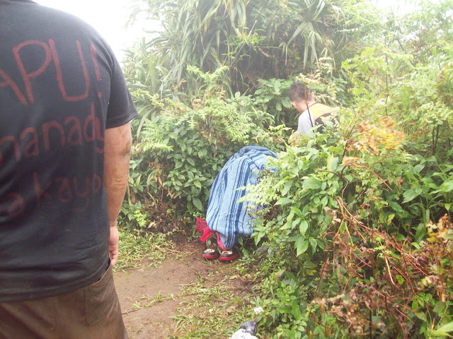
Anyway, as we were eating pancit canton and rice at the small store back on top of Buruwisan Falls, he told me the story. He said he saw a man in green shirt following me, hinting that it wasn’t really a man per se because when it ran to the far side of the river to hide from the guide’s eyes, it vanished.

Now, I haven’t been back to Mt. Romelo after that. I would love to go there again, though, because I failed to go to Batya-Batya Falls during my first visit. The next time, however, I don’t wanna be with just a guide.

Follow me on Facebook and Twitter.

Day Hiking (Hidden) Buntot Palos Falls

0 comments

It was supposed to be just plain mountain climbing but K, my climb buddy, wanted to go "chasing waterfalls" so we went to Buntot Palos (or Hidden Falls, as what the falls is known to the locals) last Sunday, July 24, 2011.

139_0018

We didn't get a guide anymore cuz we heard the trail was pretty easy to follow. You just have to lookout for this flat rock in the middle of the trail right after passing the second stream (sapa). A little before that rock is the almost invisible trail to the left that goes down to the campsite.

Once you reach the campsite, there's another trail to the left that leads down to the falls area. It was very steep, reminiscent of the steep trail that leads down to Buruwisan Falls. But K seemed to find the descent so easy. I took a video of him at one point.

You have to cross the water in order to get near the falls. The rocks were quite close together but there's this one hop I had to make that I couldn't do. The rock was inclined and a little far from the one I had to hop from and the surface was wet and looked so slippery. I couldn't really trust even the Merrell Barefoot I was wearing with my life. LoL! I was afraid of slipping and falling and getting carried away by the strong current of water. Look at where I stopped in the video and how K laughed.

The Buntot Palos falls was grandiose! It looked even more beautiful than Buruwisan Falls in Mt. Romelo. It has a 40-meter drop that breaks into large rocks forming small cascades before flowing into the deep catch basin. The water was cold, but not as cold as the water of Taytay Falls, making it ideal for swimming. K and I even killed some time in the water with the other four climbers that day together with some kids from Brgy. Balian who was there to bond.

One of the kids named Ronnel took this:

139_0026

We pitched the tent so we could have a place to leave our stuff while we swim. That, in the picture, was my P550 two-person tent I bought on mark down at Ace Hardware. It's not something sturdy that can shield you from the rain or strong winds, though. It's just good for purposes like a place to change clothes or leave your stuff.

But it was so hot we had lunch under the tress at the mountainside. There's a big, broken pvc pipe at that part and the guide of the other group told me the water coming out of it is potable. True enough, I drank from the refreshingly cold supply and my sensitive stomach didn't as much as get upset. I also cooked my pancit canton using it.

Buntot Palos Falls, which the locals call Hidden Falls, is now in my favorite trips list. Not so strenuous like a real mountain climb, the place was serene and the beauty of the waterfall was really captivating. It's also not so expensive to go to. An ordinary bus ride from Alabang to Sta. Cruz only cost P80. From there, a jeep to Siniloan was P36 and the tricycle ride to Brgy. Balian was only P80 per trip (but we were only charged P70 by a different driver on our way back).

I'd like to commend K for choosing Buntot Palos as our destination yesterday. It was a spur-of-the-moment plan but ended up one of our best hikes together.

139_0029

Take a look at my Buntot Palos Falls photoset by clicking this link. You can likewise follow me on Facebook and Twitter.

How to get to Buntot Palos Falls:

- ride a Sta. Cruz, Laguna-bound bus and get off at the terminal (P80)
- from the bus terminal in Sta. Cruz, ride a Siniloan-bound jeepney; ask to be dropped of in front of Jollibee or Sts. Peter & Paul Parish Church (P36)
- Hire a tricycle to take you to Buntot Palos Waterfalls (or Hidden Falls) jump-off in Brgy. Balian. (P80)
- at the jump-off, someone with a logbook will approach you, register and pay for the registration (P25)
- if you don't want to get a guide, just follow the cement road, it will soon end and you'll find yourself in a dirt road and eventually the mountain trail
- look for the barely visible path to the left between the second stream and the stone in the middle of the trail
- once at the campsite, descend to the waterfalls using the trail to the left (be careful for the trail is very steep)

Getting Lost in Mt. Kalisungan

0 comments

Before my climb buddy started school last month, we decided to climb again. Dayhike destinations are already becoming rare, though, cuz we have already climbed the ones near Manila. If we could avoid it, though, we really wouldn't go to Mt. Kalisungan without a group. Holdups and getting lost stories in the jump off were so all over the internet and could we avoid that place, we would choose a different destination.

But we couldn't.

136_2020

So last June 8, 2011, K and I braved the bad weather and went to Calauan, Laguna to climb Mt. Kalisungan. We boarded a Sta. Cruz-bound bus in Alabang and told the conductor to drop us off at the Duck Junction in Victoria, Laguna. He said okay so all the while, we thought he knew where the place is. Good thing that at one point, K decided to ask him again if we're still far from the Duck Junction. A man sitting across the aisle overheard us and said we're already past the said junction. It was only then that the conductor said he knew Victoria but didn't know exactly where the Duck Junction was. Okay so he was planning to drop us off at the boundary of Victoria and the next town? Good grief!

We got off the bus and stopped a passing trike. The trike driver knew where the Duck Junction was and even agreed to take us to Barangay Lamot 2. There are actually two jump-offs you can choose from to climb up Mt. Kalisungan: Erais Farm and Field of Faith Sanctuary. Erais Farm has a very established but steeper trail, while Field of Faith has "forky" but moderate trail.

It would be rational to think that first timers on this mountain who wouldn't want to shell out cash for a guide would choose Erais Farm. But mind you, there's an infamous ex-convict residing there, well-known for terrifying climbers (or so the internet says). There are also stories of hold-ups in Erais that's why we shied away from using that jump-off.

So we chose the "forky trail" of Field of Faith Sanctuary located in Barangay Lamot 2. We'd rather get lost (at least you could retrace your way back) than give our stuff to "charity."

The barangay hall/registration area of Barangay Lamot 2 is just in front of the cement road leading to Faith Chapel. There was no registration fee but they would ask for donations. No one in there, though, could give us any idea at where to turn at the road fork.

field of faith sanctuary

We thought only common sense would be enough to lead us to the right trail but we were amazed at how the trail split. First one was at the end of the cement road, which was in front of the Faith Chapel, where we were faced with three paths. We saw a gardener who was probably in his early twenties, and asked about which path we should take for Mt. Kalisungan. He pointed us to the right and we gladly thanked him. The trail split again into three after a while, and to three again after quite sometime.

We ended up in a house full of kids who called their Lola when we started asking. The lola, though, didn't know about the mountain we were talking about even if we showed her the pictures we printed out from the internet. She pointed us to another house which was so far from hers, and likewise, people from that other house didn't even know where Mt. Kalisungan was. We dropped names like Mt. Kalisungan, Mt. Calauan, and Mt. Nagcarlan – the alternative names of the mountain according to Pinoy Mountaineer – but they were clueless and looked at us like we were crazy for wanting to climb up a mountain on a rainy day.

You see, it rained the minute we left the barangay hall. I had no poncho cuz I gave it to Christian (my little guide in Mt. Talamitam) and Ace Hardware ran out-of-stock of ponchos when I went there the previous night. K, though, had on his jacket which he thought was waterproof but was actually not, he ended up using his big yellow raincoat when he realized he's getting wet to the skin.

A teenager from the second house pointed us to a trail that would lead us to another house where we could ask. At that point, we were already thinking of retracing our steps to take a different trail from the first fork at the end of the cement road, but decided to go to the third house first. And it was a good thing because the old couple living there knew the mountain we're talking about.

The old man, perhaps in his late 60s (I'm no good at telling age but he really looked old), whose name was Ben, looked at the pictures we brought. He said that the picture from Pinoy Mountaineer labeled Mt. Kalisungan and the summit picture didn't go together. According to him, the labeled picture was a mountain they own, and the summit picture belong to the other mountain in the opposite side.

But the most important thing was, Tatay Ben (short for Benigno) decided to bring us to the point of the trail where we "wouldn't get lost" anymore. I was so amazed at how Tatay Ben still walked so fast despite his old age. I silently wished I'd be as strong as he when I get old. The old man wouldn't accept anything from us. Not money, not sandwiches. He said he was only happy to help, and we're the second lost mountaineers he encountered. We couldn't thank him enough for his kindness.

The wind and rain got harder as we went higher up Mt. Kalisungan. I had to put my cameras inside a Ziploc to keep them dry. And that was the second time I wished I had a waterproof camera (the first one was when it rained while I was watching the Pasayahan sa Lucena parade).

k after lunch

It was 12:30 PM when we reached this big tree and decided to stop by for lunch. The tree's leaves and branches somehow shielded us from the rain. I had sandwiches and pouched pork and beans while K still had to cook his pancit canton. None of us brought rice cuz it's really heavy on the bag. We also took that time to call home using my PLDT Landline Plus that has been so useful when I go out-of-town.

We only remained there for half an hour and carried on with the hike. The trail still split numerous times. We ended up in a kaingin at one point so we went back to the last fork and went the other way. We were already so high up when we stumbled into a sloped clearing that looked like another kaingin with no crops. Beyond the clearing was a wall of cogon grass that had no opening. We wouldn't wanna go back again because that would mean going two road forks back. We just decided to go through the cogon wall and make our own way.

It wasn't an easy task, what with the strong wind and rain making our ordeal with the taller-than-us cogon more difficult. After about 30 minutes of finding our way through the field of sharp-edged grasses, we caught sight of the summit. Soon after that, we stumbled upon the main trail going up. We almost shouted with relief.

K almost gave up before we found the right trail. More than once did he talk about going back. But I couldn't show negativity when my buddy showed it first so even if I felt like going back myself, I kept on telling K that we're on the right track (while making our own trail through the field of cogon grass LoL!).

But, at least, our efforts paid off.

The white cross near the summit was still standing while we were approaching. But as soon as we got near it, the cross gave to the force of the wind.

We stopped for a while to take some pics and to admire the beauty of the 360-degree view of Laguna and nearby towns. The seven lakes of San Pablo were really visible. But remaining inactive in the middle of strong wind and rain made us shiver. It was really cold!

We immediately went to the summit so we could finish it off and head back. We summited Mt. Kalisungan at 3:20 PM of June 8, 2011. A piece of wood sticking up from the ground was what remained of the wooden cross at the summit. The wood was adorned with a piece of worn-out black shirt (probably from a fellow mountaineer). We took pictures by the wood just the same.

k and i

Aside from the seven lakes of San Pablo, Mt. Makiling was also visible from the summit as well as Mt. Cristobal and Mt. Banahaw.

Having not climbed Mt. Makiling yet, K had his pic taken with Mt. Makiling in the background. LoL!

We headed back down after the photo-op. We were already midway down when I realized we didn't have a pic at the summit together. Rough weather really make you forget about things. Oh well, it was too late to go back and we were in a hurry not to let the dark catch us in the mountain.

It was a very smooth descent since we used the Erais Farm trail. We would have wanted to drop by Tatay Ben's place on our way down but we couldn't find the trail we used in going up anymore. Well, that's unless we go through the cogon field again. But that's already insane.

We had this sort of fear of Erais Farm due to what we read on the internet. And somehow, the meanness of the place was confirmed when while walking the tree-lined path of the farm, a man going our way eyed us like he's mad. We greeted the usual magandang hapon but he just eyed us like we're some sort of unwanted persons around.

erais farm

Oh well, that's what you get when you pass through a private property unannounced.

People of Lamot should really develop the trail at the Field of Faith Sanctuary (and please make directional signs like the ones in Pico de Loro). After all, that's where the barangay hall/registration area is. I'm sure more mountaineers would frequent Mt. Kalisungan if (1) the trails are established you won't need a guide anymore; and (2) there are no more encounter with mean individuals and hold-up at the jump-off stories being told.

Click here for more of our Mt. Kalisungan photos.

How to get to Mt. Kalisungan:

- ride a Sta. Cruz, Laguna-bound bus and drop off at the Duck Junction in Victoria (*P91)
- hire a trike to take you to the barangay hall of Barangay Lamot 2 or, if you brave it, to Erais Farm (*P15)
- register at barangay hall. no fixed reg fee but they ask for donations; you can also ask the officials for a guide if you want one

* fare prices indicated are as of June 2011

136_2021

Below is a collection of videos I took during our Mt. Kalisungan climb:

Don't forget to follow Profound Bliss on Facebok and Twitter.

MakTrav with MSOC

0 comments

The last mountain that I climbed was Mt. Pundaquit when I went with the MSOC to Anawangin Cove. It was November last year.

My friend K also invited me to their Batulao climb last January 9 (Sunday) but he texted me January 8th while I was already in Calapan. I couldn't actually go home Saturday night from an out-of-town trip and leave again the following morning for a mountain climb. Yea, pwede, but my Nanay would fume mad and Princess would feel depressed two days in a row and that's bad.

Then some of the MSOC applicants invited me for a MakTrav the following Sunday, January 16th, and I immediately said yes. It would be my first major climb ever.

K didn't join the team so I went to the Jam Transit station in Buendia alone at 3 AM. It was even baha in Pasay Rotonda because Manila Water was working in the area. Most of the team members were already there when I arrived.

We left for Sto. Tomas at 4 AM via an air-conditioned Jam Transit. The trip cost P90.00 because we were all charged student fare. Majority of us were students, anyway.

It was a pleasant team. I already met Sir Maldz and three of the applicants during the Pundaquit-Anawangin trip so I didn't feel like an outcast anymore. Not that they made me feel like an outcast the first time, it's just that it's easier to travel with people you already know.

The kids (as I call the applicants) ate their packed breakfast even before the bus left the station. I didn't eat. It's hard for me to eat that early in the morning. I slept through the trip instead.


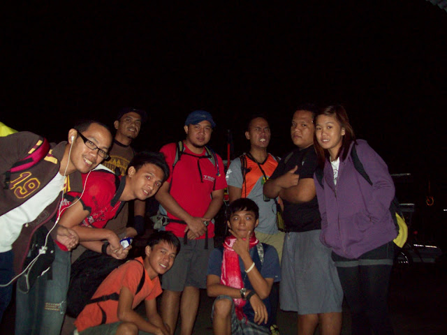
the Maktrav team before leaving Sto. Tomas town (clockwise from left) me, Prince, Sir Maldz, Sir Jury, Sir Aim, Troy, Khollin, Rain, and Akil

We were at Sto. Tomas after an hour and hired a tricycle to take us to the jump-off in San Bartolome. The air was so cold that morning you could hear the wind howling and the trees were swaying like mad.

After praying (which was led by Troy), we left the registration area at exactly 6 AM. It was still dark but not much that we would need headlamps. But OC as I am, I wore the headlamp around my neck just in case.

With an elevation of 1,090+ MASL and a difficulty of 6 out of 9, MakTrav is classified as a major climb. And before this, the hardest mountain I climbed was only Pico de Loro with the the bird's beak going almost 90 degrees.

Good thing I expected the worst because the trail, though moderately steep at first, became difficult midway up. The wind became stronger and it made the passage across the cogon area very difficult. The sharp blades of the tall grass were slapping at our skin.

We arrived at the Melkas campsite at about 10:30 am and decided to have an early lunch. It started to become so cold with the wind bringing in the fog. It was there where I first set eyes on limatiks. These blood-sucking creatures are mean. You won't really feel they're sucking on your skin unless you see them. Too bad none of us were able to take pictures of the limatiks. But here's a vid of the Melkas campsite.

Passing through the Melkas Ridge was a little nerve-wracking. Prince, one of the applicants who says he's afraid of heights, almost crawled at the ridge.


Troy, Khollin, Prince, me, and Sir Aim

We arrived at Peak 1 at exactly 11:54 AM. Sir Maldz, being the leader, arrived a few minutes ahead of us, while Rain, Prince, Khollin, and I were the next to arrive. Troy and Akil were at the tail with Sir Jury and Sir Aim (who called his girlfriend that's why they stopped).


Sir Maldz, Rain, me, and Prince at Peak 1

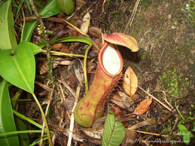
Aside from limatiks, trapper plants can also be found in Mt. Makiling.

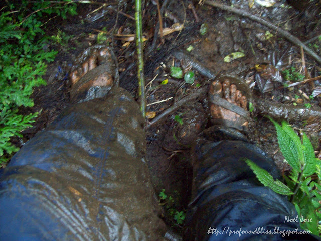
After Peak 1, the trail becomes more complicated. We found ourselves either clinging on vines and ropes or sliding on mud. The mud was very evident on my feet and on the Lagalag trekking pants that I have only used for the second time (the first being Calapan).

The temperature became lower as we headed for the summit. And since the kids didn't know it was that cold in Mt. Makiling, they didn't bring jackets aside from Khollin. I have to tell you, though, that my thick Bench fleece wasn't enough for the cold. I should've brought with me a windbreaker.

And since the kids had no jackets, one of them, Akil, frightened us all when he started getting chills.


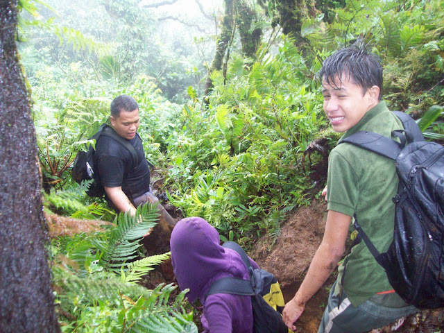
Akil in green shirt before the chills; all wet in the rain.

Troy volunteered to carry Akil's bag and Rain became his official alalay. We really feared hypothermia might have hit him but it was too late to go back. We were just a few minutes away from the summit and the trail going back was very complicated.


Me at Mt. Makiling's summit

When we reached the summit, they made Akil sit in the bushes to hide him from the wind. Sir Aim also gave him his jacket and threw whatever they could throw on Akil just to keep him warm. Good thing Sir Aim had a stove that he was able to heat water for Akil.


That's Akil covered up in layers of clothing to keep him warm. Sir Aim behind him desperately trying to heat water, protecting his fire from the strong wind.

When Akil felt a little better, we immediately took off for the trail going to Los Baños, disregarding Peak 3. But it was still a long trek going down. It was 2:45 when we left the summit. Sir Maldz and Sir Jury led the team while Sir Aim stayed at the tail. The two sirs walked so fast, followed by Rain, Akil, and me. Good thing the trail had no ligaw because I suddenly found myself alone in the middle of the trek. Rain and Akil walked so fast that I was left behind, while the others in the tail group were much slower than I was that they were so far behind me!

Then I remembered Sir Jury's kwento before we set off that morning. He related how one time, he and another MSOC member couldn't find their way out while descending Mt. Makiling. They would keep on walking but would find themselves in the same place over and over again. It was almost dark that time and they knew what was happening. Namamaligno sila. Then they saw a little boy in white sando ran across the trail in front of them, before disappearing in thin air. After that, they were able to find their way out.

So I feared the same thing would happen to me. It would be worse cuz I was alone. So I walked fast, took my whistle attached to the strap of my new Hawk daypack, and whistled like mad. No answer though, either from Rain and Akil ahead of me, or from the group of four behind me. I walked alone for almost an hour and it was getting dark. I had my headlamp with me, but still!

What's worse was when I felt the need to do number 1. What if I peed on a punso or something? But I couldn't help it anymore so I just said "Tabi-tabi po!" and did it. I haven't been so frightened peeing in my whole life.

I was also looking around if I was passing by the same area over and over again. If what happened to Sir Jury happened to me that day? I really wouldn't know what to do. Imagine being mamaligno alone!

Anyway, I suddenly saw Rain and Akil ahead. They slowed down because Rain's foot got injured. The kid was wearing a pair of Nike slippers. He thought MakTrav was an easy climb because it was just a dayhike so he didn't wear anything appropriate.

But I was really lucky his foot got injured. At least it made them slow down.

It seemed like an endless trail, really. We reached the Los Baños jump-off after walking non-stop for three-and-a-half hours and it was already dark that time. Sir Maldz and Sir Jury were taking a bath when we arrived at the jump-off. I just washed-up, though. I fear pasma.

After about 30 minutes, the tail group arrived, dirtier than us. They only had one headlamp making the trek in the dark forested, muddy trail a very messy feat. Good thing the water coming out of the pump was lukewarm so some of the kids took a bath.

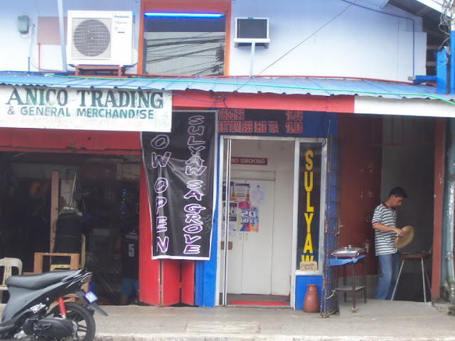
After cleaning up, we walked to find a jeepney that would take us to where we could have dinner. We stopped at Sulyaw sa Grove and I have to tell you, the food there was cheap! It was just so bad that my camera ran out of battery that time that I wasn't able to take any pic of/at the resto. So here's Sulyaw taken from kainlb.blogspot.com:

I have to tell you, if you're going to UPLB, you have to drop by Sulyaw to experience good food without shelling out a lot of moolah. There's a catch, though. You have to bring your plates, etc to the counter at the far end of the restaurant after you eat. But they won't make you wash those naman. So okay lang.

After eating, the three sirs went off for a drink, while we head to Alabang. The rest of the team were from Quiapo so they still had to take another bus ride from Alabang, while I took a jeepney to go home.

I must say MakTrav is one tiring dayhike. My muscles ached again as if it was my first climb. But there's no regret whatsoever. MakTrav was one heck of an experience.

Here's a compilation of the pics and videos of my Mt. Makiling Traverse with the MLQU Stallions Outdoor Club:

The Waterfalls of Mt. Romelo

2 comments

I woke up around 3:30 AM that August 1 morning, so excited to go to a waterfall in Laguna which boasts of its freezing-cold water. Gerald, the friend who went with me to Kwebang Lampas last month, was also supposed to go with me on that waterfall trip. I texted him before I took a shower telling him to get his lazy butt out of bed. We agreed the night before to meet at my house 4:30 AM so we could start early. Ever so excited, I was all set to go a few minutes before the agreed time. But when I checked my phone for his reply, I found none.


By that time, I kinda knew something was off. I started calling him to wake him up, thinking he overslept. I rang his phone over and over for 2 hours. Nanay left for church at 6 that morning and she reminded me not to leave if Gerald wouldn’t make it.


But then I was all set wearing my new Penshoppe shorts, and with my rucksack packed especially light, I didn’t want anything (read: being stood up) to get in the way of having an eventful Sunday.


So I left home to go out alone. It was already 6:30 AM and I didn’t have any specific place to go. I didn’t wanna go to that waterfall-with-freezing-cold-water anymore because I heard it gets so crowded with local tourists on weekends. Going there alone, in the midst of people having fun swimming and picnicking, would be so sad.


While commuting towards the bus terminal in Alabang (you can always start your waypoint at the bus terminal), I fished out my tickler which I always keep in the rucksack mesh pocket, and searched in my list of destinations (something like a wish list) that I have. And since it was supposed to be a waterfall day, I wanted to keep it that way. I have another waterfall on my list, and I heard not many people go there even on a weekend – the Buruwisan Falls in Mt. Romelo.


At 7:30 AM I boarded a bus to Sta. Cruz, Laguna. After two hours, I was already seated beside the driver of a jeepney bound for Siniloan (pronounced Si-ni-loo-an). It was almost an hour ride, passing by the towns of Pakil, Pagsanjan, and a couple others I’m not familiar with. At 10:30 AM, which was quite late considering I still have to climb a mountain to reach the falls, I was dropped off across the road from a Jollibee branch and boy, was I happy! I crossed the road deciding to have a quick brunch, but once inside the store, something on the other side of the road caught my eyes.


Sts. Peter & Paul Parish, Siniloan, Laguna


I was even happier because I wouldn’t have to ask the locals for direction to their local parish anymore. Across the road, actually it’s the side of the road where the jeep dropped me off, was the Saints Peter and Paul Parish of Siniloan, Laguna. I left Jollibee and went to the church first, almost forgetting my promise to visit a church first thing upon arriving at my destination.


After a quick round of the church, I immediately left, not dropping by Jollibee anymore because it was almost 11 AM.


Mt. Romelo Jump-off Point in Barangay Macatad


I quickly hired a tricycle to go to the jump-off point in Barangay Macatad. I thought it would be a problem getting a guide, but with my rucksack and all, people at the jump-off already knew where I was headed and they all offered to be my guide. I chose a 46-year-old man who was shorter than me but looked good-hearted and talked with much zest.


The ever-so-kind guide, Ray Suplado


His name is Ray Suplado. I actually thought he was kidding with the surname but eventually found out that it was real.


The Registration Area


Anyway, I’ve already read about the official mountaineer guides at the registration but was also aware that the locals ask for a cheaper fee so I decided to just hire someone from the jump-off.


Muddy Trek


I must say that I underestimated Mt. Romelo, with its 240+ MSL and being the mountain that newbie mountaineers climb. I actually thought it was an easy trek, but it was not. The mud was horrendous. What with the tropical storms that hit the country and the almost daily afternoon rains that that part of Luzon (including Metro Manila) gets? I wouldn’t wanna dwell, though, on the hard climb because it being my first real mountain climb (I also climbed a quarter of a mountain in Laurel, Batangas some 10 years ago and it was not a climb at all when compared to Mt. Romelo), I know I could go on forever detailing how hard it was to walk up a slope on a slippery mud and how harder it was to cling on those small cement posts they had put up on the very steep parts of the trek.


A Very Steep Descent to the Falls


After almost 2 hours of walking, I felt so excited when I heard sounds of the water rushing. I knew it was the falls. And after one very steep descent, I was rewarded with this view:


Buruwisan Falls


There were around 6-8 persons about, swimming and taking pictures. One group was rappelling. I wanted to try to rappel but I was informed by my guide that you have to bring your own rappelling stuff and do it at your own risk. So never mind that.


I told my guide that I wanted to finish touring the place before we eat lunch so we headed off to Lansones Falls by following the flow of the water from the Buruwisan Falls. A few feet from the Buruwisan Falls, there was another river that connects to the one coming from the falls. We trekked the side of that river, going against the flow of its waters.


The River Coming From Lansones Falls


Rock formations were so picturesque that I stopped numerous times to admire their beauty.


Lansones Falls


Arriving at Lansones Falls, I gladly found out there was not a single mountaineer in sight. Me and my guide were alone and he told me to swim even just for a bit. I didn’t wanna swim because I was so tired but realized it was better to swim there than at Buruwisan Falls where a group of photogs was present. LoL!


So I took all my valuables from my pockets and neck and put them at the mesh pocket of my rucksack. After swimming, I forgot to take my beloved Cherry Mobile phone from the mesh pocket and that’s how it got lost. Walking in the water, jumping from one rock to another, I so many times lost my balance, bending over and stuff and that’s how the phone fell from my bag. I really should have put on the rucksack's rain cover but it was already too late when I realized that.


Old Buruwisan Falls (My Sandugo sandals just have to make a cameo. LoL!)


My guide also took me to the top of the Old Buruwisan Falls. Coming from the Lansones Falls, we trekked back to where the Lansones river joins the Buruwisan river and followed the water until the drop.


The Camp Site on top of Buruwisan Falls


After that, we climbed back up the very steep path we descended earlier to have lunch at the sari-sari store situated at the camp site which was near the drop of the Buruwisan Falls, near the rappelling spot. The guide told me we could ask the tindera to cook for us, but to our dismay, there was no rice at that time. We just settled for four packets of Lucky Me Pancit Canton which cost 13 pesos each. How much was the price of having it cooked? Depends on how much you'd be willing to give. I asked if a hundred pesos was enough for the 4 pancit canton and a bottle of Mountain Dew that cost 23 pesos, and the store owner said it was. The canton and softdrink already cost 75 pesos. 25 pesos wasn’t bad at all for the cooking, plus plates and forks. I had Hansel biscuits in my bag and I gave two of them to my guide.


The Way to Batya-Batya Falls


I knew there was a waterfall called Batya-Batya on that mountain and I asked my guide to take me there. We tried, but the water was so deep we would have to swim. The guide tried to show me how deep it was. A few steps into the blue-green pool and it was already neck-deep. Swimming wasn’t a problem at all. The problem was my bag which I didn’t pack water proof. I would have done it, though, if I knew I would be mountain climbing that day.


There was a trek in the mountain going to Batya-Batya but it was so steep my guide was worried I wouldn’t be able to descend Mt. Romelo and get to Sta. Cruz in time for the last bus bound for Alabang. It was almost 4 PM that time. He, though, offered his house for me to spend the night if I really wanted to see Batya-Batya Falls and another one named Sampaloc Falls, but I declined. Nanay would kill me. There were no cellphone signals on that part of the mountains. No Smart, no Globe, no PLDT Landine +. I knew she’s already worried that I went out nature tripping alone, what more if I didn’t go home without even a text or call?


The descent from Mt. Romelo was a breeze. I was actually surprised to find a group of mountaineers resting in front of an abandoned hut on their way down.


The Mountaineer's Stop-Over


By 5 PM I had already cleaned-up at the Mountaineer’s Stop-Over which asks for a 20-peso-fee for the use of the toilet and bath. I wasn’t able to use the toilet, though, because look at what you would have to go through if you have to do number 2:


Anyway, by 5:25 PM I was already at the Siniloan town proper, in a jeep bound for Sta. Cruz. I reached the Sta. Cruz bus terminal by 6:30 PM and was in Alabang by 8:20 PM.


Perhaps I was really destined to learn the art of travelling alone that first day of August 2010. If Gerald had come with me and we went to that other waterfall with all the local tourists who wanted to swim in its freezing waters, I wouldn’t be able to climb Mt. Romelo and see 3 waterfalls all in a day.


Now I can say that I have travelled alone to a new place, and can again travel alone in the future if I have to. Travelling with a buddy is fun, but travelling alone also has its perks and advantages. For one, you can visit three different falls one after another before you even have lunch and no one will complain (the guide didn’t, anyway). Two, your time is in your hands. You don’t have to worry about going home early because your friend wants to. Three, you can go wherever you want. I have originally planned a Mt. Romelo climb but Gerald has asthma and it can attack him while climbing.


Posing at the Lansones Falls (Thanks to Kuya Ray for this pic)


How to get to Mt.Romelo/Buruwisan Falls (from Alabang):


* Ride a bus to Sta. Cruz, Laguna (fare of a non-aircon bus from Alabang is Php77.00). Drop off at the Sta. Cruz bus terminal which is the end-point of that ride.


* Across the road from the terminal, take a jeepney bound for Siniloan (fare is Php35.00). Ask the driver to drop you off in front of Sts. Peter & Paul Parish or Jollibee.


* Beside Jollibee are tricycles you can hire to go to Mt. Romelo’s jump-off point in Brgy. Macatad. Special ride costs Php60.00.


* At the jump-off, you have the option to hire one of the locals as guide (mine asked for Php250.00 one-way so I paid Php500.00 because I didn’t wanna descend alone). If you don’t want a local, you can proceed to the Registration Area to get one of the mountaineers there as guide.


* If you decide to get a guide at the Registration Area, just follow the road until you reach the Mountaineer’s Stop-Over. Facing it, turn left and follow the road lined with trees. You will reach a river, cross it and follow the grassy path until you see a small house (pictured above) that is the Registration Office. Pay Php20.00. They’ll give you an ID if you’re staying at the mountains overnight, and not if you’ll just do a day hike.


(If you’re from Manila, make sure to schedule your descent so you’ll have enough time to reach the Sta. Cruz bus terminal to catch the last bus going to Alabang at 8:00 PM. Tricycles that will take you to Siniloan town are owned by the locals so there’s no problem with that. I was told, though, that jeepneys from Siniloan going to Sta. Cruz are only until 7:00 PM.)

Sts. Peter and Paul Parish, Siniloan, Laguna

0 comments

I went to Siniloan, Laguna last Sunday and upon arriving at the town proper, I immediately looked for the local parish. It's one of my personal rules to first and foremost visit the local church of wherever my destination is, to give thanks for arriving there safe and to pray as well for the safety of those I left at home.

Since I wasn't really prepared for a Siniloan trip (I was scheduled to go to Majayjay that day), I wasn't able to search the net for its local church beforehand. Anyway, I was sure a local or two would be willing to give me directions to their local parish if I'd kindly ask.

I didn't have to ask anyone, though, because when the jeepney driver dropped me off in the intersection where I could hire a tricycle to go to my destination, it was in front of a church.


It's not facing the road, like most churches. It's turned sideways and is flanked along the road by all sorts of stores. It's still prominent, though, because it's way higher than the shops fronting it so you won't, by any chance, miss it when you're at the area.


When you get inside, the first thing you'd notice are the life size angels holding the Holy Water stoups.


The aisle is long enough for a descent bridal walk.


And the stained-glass windows give the lighting inside the church some drama.


I wasn't able to attend mass, though. I arrived at Siniloan around 10:30 am and the Sunday services were already finished. If it's in my local Taguig parish, that time would still be so busy with the church bursting with well-dressed ninongs and ninangs for the binyag.

Related Posts with Thumbnails