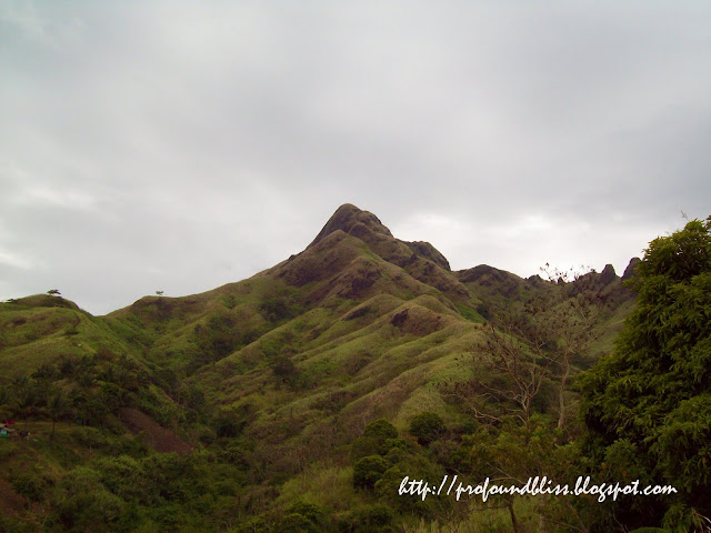
Showing posts with label Batangas. Show all posts

Mountaineer goes missing in Mt. Maculot

0 comments

Another mountaineer has gone missing.

Victor Joel Ayson

Victor Joel Ayson went on a solo dayhike up Mount Maculot on Easter Sunday, March 31, 2013. It was 2:30 AM when he left his bag at Mang Manuel’s store.

He successfully reached the Rockies campsite because he was seen buying a bottle of mineral water at the campsite store (which mountaineers fondly call 7-11) around 9:00 AM.

After not being in contact until Monday, his friends and family started getting alarmed. Search and rescue operations have been organized since Monday night but all were unsuccessful in finding him.

According to Mang Manuel, an experienced Mt. Maculot guide and owner of the Mountaineer’s Stop Over & Store in Barangay Tico, there have really been instances when even the locals would get lost in Mt. Maculot due to engkanto or the entities that we do not see with our naked eyes.

I have personally traversed the said mountain twice and has done four solo climbs of the Rockies campsite, and I must say I believe in what Mang Manuel suspects of what happened to Victor.

But the news didn’t say if the missing mountaineer only climbed up to the Rockies or did the traverse. Did anyone know of his exact plans that day? The Rockies is just a one-hour hike and if he climbed at 2:30 AM alone and was still at the campsite at 9:00 AM, he might have found a company (made a new friend or bumped on a mountaineer that he knew) for him to have lasted such long hours up there. That, or he’s a better loner than I am.

Next point, did he buy a big bottle of mineral water? If he did, it could be that he was preparing for a traverse. I’m sure, however, that someone has noticed where he went after the campsite. Aside from the fact that it was a Sunday, and an Easter Sunday at that, the campsite store only operates whenever the place is crowded. And with a crowd at the campsite, someone could have noticed where he headed.

The “barangay” should check with the mountaineers that are on the log book from Black Saturday to Easter Sunday. And just to be sure, ask those that have climbed on Monday, too.

The Rockies can be very dangerous especially with strong winds. And I only stayed at the campsite during those times I was alone. Why? Because I could have easily slipped and fell and disappeared without anyone knowing. Falling to the waters of Taal Lake would be a “better” accident if you knew how to swim, but falling towards the forested area several meters down below would be very tragic because (correct me if I’m wrong) that is an unexplored area (read: no one goes there).

But what if he did the traverse. Alone. That instantly gave me the goosebumps. Why? Because going back to what Mang Manuel said, those entities are indeed true. Read about my scary traverse of Mt. Maculot here: http://profoundbliss.blogspot.com/2013/01/what-do-maculot-romelo-and-manabu-have.html

Follow me on Facebook and Twitter.

photo: Victor Joel Ayson’s Facebook

What do Maculot, Romelo and Manabu have in common? - Part 3

0 comments

This is the third of a series of posts, and I really hope will be the last, about ‘peculiar’ things that I have experienced in the mountains.

So I am/was fond of climbing alone, but only in mountains that I already know the trail of, and which I label as ‘safe’ because of easy trails.

Two mountains that I climb alone (and without a guide) were Maculot and Manabu Peak. I already blogged about what happened during my last Maculot climb which actually triggered my desire to write about my ‘peculiar’ experiences. You can also read about my Mt. Romelo experience here.

This time, however, I’m gonna write about a very strange thing that happened to me in Manabu.

I arrived at the jump off past 1:00pm of September 20, 2012. Based on previous Manabu climbs, I only needed at least three-and-a-half hours for a ‘round-trip’ (that doesn’t include the ‘summit time’) so I was sure I’d be back at the jump-off way before 6:00pm.

It had just rained the previous night so the trail was wet and the stream to be crossed was a little deeper (below the knee) than usual. It had always been muddy in Manabu, anyway (or at least every time I went there), so the slippery trail was nothing new.

A few meters past the last occupied house (Mang Pirying’s hut not included) but before the split in the trail that will lead you either to the grotto or to Mang Pirying’s hut, I noticed a very thin dog off to the right. He (instinct told me it was a he) ran away as he saw me, but only far enough that he could still see me and bark. His voice was weak and kinda muffled. I think there was something wrong with his tongue. My guess was that it was cut off because his bark was very unusual-sounding.

dog along the trails of Manabu Peak

Being a dog lover, my heart almost broke at the sight. He was so thin so I guess no human was taking care of him. Or perhaps he was disowned. I had in my backpack three pieces of boiled eggs that I bought from the vendor on the bus on my way to Lipa. I decided to give one to the obviously starving dog. He was still barking nonstop at me, but he didn’t go farther away as I dared to get near.

I already have an HRIG shot anyway so I’d just need a booster if ever he was rabid and bit me.

About three feet away, I softly tossed the peeled boiled egg his way. He started to run away perhaps because he thought I would hurt him, but then he saw the egg and stopped running . He still kept on barking at me and I realized, given his situation, that it was hard for him to trust me, or anyone for that matter.

I gathered he wouldn’t eat the egg with me there so after saying goodbye, I walked on so he could eat the egg in peace.

I wanted to take the trail that would pass by Mang Pirying’s hut, and go down that way as well because there was this dark part in the other trail (the one with the gigantic boulder) that just gave me goosebumps everytime.

(I would like to build up suspense on this part but really, I wanted to just get this post over with because I’m having a hard time writing this. So without further ado:)

But lo and behold! I just found myself looking at what I didn’t want to believe was the grotto already!

I literally stopped in my tracks and looked around. How could it be the grotto when I haven’t yet passed that split in the trail that would lead me to either the grotto or Mang Pirying’s? Could I have missed it, really, despite the bench and directional signs? And on my numerous trips to Manabu Peak both alone and with K, walking up to the grotto couldn’t have taken that short a time!

I didn’t wanna scare myself so I just continued walking, past the grotto, past that eerie boulder, and onto that little grassland where that Cooperative Planting Project banner could be seen.

I walked fast, focusing on how to catch my breath as I didn’t want to think about how I was “teleported” some 30 minutes forward. I didn’t wanna entertain the idea but later on, I asked myself if it was the dog. It may be funny to think and I initially didn’t want to write about this thought but, was the Virgin Mary at the grotto pleased at my actions that she made my trek faster by cutting the trail short towards where she was?

It was a lonely hike overall, and eerie for that matter, because not even Mang Pirying was in his hut when I passed by on my way down. I found a black cat and a black dog in his house, though, which made the experience eerier (although we at home also own a black cat).

Mang Pirying's black cat and black dog

And then there was this caged “wild cat” also:

Mang Pirying's caged wild animal

As I got near that split in the trail on my way down, that Twilight Zone theme (I am a fan) was playing in my head. I almost didn’t want to look. But it was there - the bench, the signs. How could I have missed them on my way up?

Follow me on Facebook and Twitter.

What do Maculot, Romelo and Manabu have in common? - Part 1

0 comments

I climbed Mt. Maculot every week last December to lose some inches on my tummy. And because not everyone likes to climb the same mountain over and over again, and because I'm really a loner, I climbed those four times alone.

the blogger at Mt. Maculot's Rockies

The Rockies campsite is safe to climb alone. (I can almost hear my few more experienced mountaineering friends disagreeing with me.) The trail is wide and there are no forks aside from one early in the trail, but there’s an arrow pointing to the right direction so I really don't see how anyone could get lost.

My first two weeks were bliss. I was literally alone at the campsite aside from a big tuko on the first and a monkey on the second week. I was able to pray (which I do secretly when there are mountaineers around) for the safe climb, lie down on the tables, close my eyes and savor the quiet sounds of wind on the trees and the idea of being alone 300+ meters above sea level.

But was I really alone during those times that I thought I was?

I'm going to fast forward to January 3 because my third and fourth solo climbs on the third and fourth weeks of December were full of happy mountaineers along the trail and at the campsite. They were really friendly, aside from a few shy ones, but I wish I could teach myself how to become a large group type of person.

Going back to that first Thursday of 2013, it was a happy climb for me because after a little more than a year, I was able to climb again with my climb buddy K. He became so busy when he transferred school because he went back to playing the quinta drums and couldn’t find time to climb anymore.

After the holidays, though, he was a little less busy. And even if it was the last mountain we climbed together, we chose Maculot again because (1) I told him I will show him the "dila" part of the Rockies; and (2) we will do the traverse which he hasn't done yet.

I have traversed Maculot in 2010 with Danilo and a kid guide starting from Brgy. Pinagkaisahan to the Rockies down to Brgy. Tico, and I decided to do it the other way around this time. Little did I know that we really couldn’t start at the Brgy. Pinagkaisahan jump off because it is currently closed aside for foreigners. But that's another story.

After taking pictures at the so-called "dila" of the Rockies, K and I set off for the traverse at exactly 9:38 in the morning. K was excited to use for the first time his Casio altimeter watch that his father gifted him with last Christmas.

K at about 800 MASL up Mt. Maculot

We occasionally paused to take pictures and/or admire the surroundings. A little over 800 MASL, we again stopped to admire a tree with a bunch of round fruits that looked like grapes. I took a photo of K by the tree and also took pictures of the wet surroundings.

It was raining and oh-so-foggy that day. It was bearable from Brgy. Tico up to the Rockies, but it was wet and muddy after the Rockies campsite onwards.

After taking photos, it’s time to continue walking. “Let’s go,” I told K who was in front of our two-person line. He turned away from me to resume the trek but suddenly turned back again, his gaze searching somewhere behind me.

“May tao sa likod mo,” (Someone’s behind you) he told me in his typical flat tone.

Thinking he meant there were other mountaineers behind us, I turned back as well to search for them at the trail behind. There were none, though, and when I turned back to look at K again, I sensed through his tensed expression that it was something else.

I’m not a mind reader, but the two of us have climbed mountains as a duo long enough to read each other’s thoughts just by the movements of our eyes.

At that point, I was reminded of the “green man” my guide saw was following me during my Mt. Romelo climb, reason why from there, I told K I’ll take the lead (I was the one who knew the trail, anyway). I also knew better than to talk about “what” K saw while we were still in that mountain.

We didn’t stop walking again after that, climbing at least a hundred MASL straight until we reached the summit. We became more quiet, more cautious, and perhaps more aware of what’s around us.

We stopped at the summit for a while. There, we ate our Jollibee cheeseburgers (K is a sucker for burgers, BTW) and took pictures. When my jaw started rattling at 24 degrees centigrade because we were all wet, I decided it’s time to start the descent to Brgy. Pinagkaisahan.

The trail on that other side was as steep as I remembered. However, the rope segments were more difficult going down than how I remembered it going up.

one of the rope segments when traversing Mt. Maculot

After the second and steeper rope segment before the grotto, we bumped into a Kiwi on his way up. He was being guided by Kuya Jun. I remembered the guide as the one at the registration during my 2010 traverse. He was also the one who gave me the 14-year-old Denver as guide. He remembered me as well and he talked like an old friend, explaining why there was a new fork in the trail near the summit and why they don’t allow mountaineers to start trek at Pinagkaisahan anymore.

I wonder why he gave the mountaineer from New Zealand a special consideration, anyway. And with that, your guess is as good as mine.

the blogger at Mt. Maculot's grotto

The area around the grotto was devoid of trees and the wind was particularly strong. We decided to eat K’s pancit canton there. After taking a lot of pictures, that is.

We completely forgot about what K saw until we were already comfortable eating burgers (again) at McDonald’s in Robinsons Lipa some three hours after.

“Ano’ng nakita mo? Naka-green?” (What did you see? Someone wearing green?) I asked K, thinking it was the same “thing” that followed me in Mt. Romelo on my way to Lansones Falls in 2010.

“Naka-white,” he answered, and I got instant goosebumps upon hearing that.

“Lalaki?” (A man?) I asked again because the one in Romelo was male, but perhaps I was also hoping the Maculot entity wasn’t what I thought it was.

“Babae.” (A Woman.)

I had more goosebumps after that, especially when K said the woman in white was standing to my left but a couple of steps behind.

All K could describe was black hair and white clothes as he said it immediately disappeared when he turned to look at it again.

I believed him, as I’ve also seen “things” like that on several occasions, the last of which was three days before this posting. But again, that’s another story.

Back at home, I told my friend Mylene about the white woman in Mt. Maculot. Mylene was a mountaineer before she married and gave birth. And then she told me a story of her mountaineering buddies hearing marching footsteps and Japanese voices during an overnight at the Rockies campsite.

My Mt. Romelo and Manabu Peak “goosebump-y” experiences coming soon.

Follow me on Facebook and Twitter.

A new mountaineer's stop-over in Mt. Maculot

0 comments

There’s new tambayan/tindahan at the foot of Mt. Maculot and it’s a good thing for those who hike during the weekends when all these so-called mountaineers’ stop-over get crowded a lot.

Tatay Ed of Mt. Maculot

This one is very near the trail head, way past UWAC but before the fallen milestone with written acknowledgements.

The good-mannered, elderly man who owns it told me to just call him Tatay Ed.

Tatay Ed of Mt. Maculot

He actually sells bottled water, soda, and even cooked food during the weekends. Unluckily for me, I climbed on a Thursday so I didn’t get to taste his cooking.

Tatay Ed said he’s constructing a toilet for the mountaineers. And we can use it for free. I just hope his free toilet wouldn’t smell.

For those who bring vehicles, he also charges nothing for parking within the area of his store.

“Bumili lang sa akin ay tama na,” he told me when I said sayang ang parking fees.

Anyway, I already saw his store when I climbed the Rockies last June, although I didn’t think it was a store because it didn’t look like one back then. It also used to be on the left side of the road. It’s now on the right.

Anyway, I’m sure Tatay Ed will sooner or later become a byword to those who frequent Mt. Maculot. Especially that he can also provide guides for those new to the mountain. It’s just sad that he didn’t have a cellphone yet. He could have been a very good contact person for mountaineers.

I’ll update this post as soon as I can get his number.

His guide rates are as follows:

P100 – up to the part na may ligaw (or where the trail splits into two)
P300 – up to the Rockies campsite
P1,000 – traverse (from Brgy. Pinagkaisahan to Brgy. Tiko)

Follow me on Facebook and Twitter.

How to get to Mt. Gulugod Baboy/Pinagbanderahan

0 comments

Mt. Gulugod Baboy/Pinagbanderahan offers a 360-degree scenic view of Anilao. From the summit, you can see the nearby Batangas Pier, Maricaban and Sombrero islands, and even the distant Mt. Maculot, Mt. Lobo and Manabu Peak.

Mt. Pinagbanderahan/Gulugod Baboy

Locals say it’s actually Mt. Pinagbanderahan that mountaineers go to, and Mt. Gulugod Baboy is the one behind it which is not easily accessible.

Here’s how to get to Mt. Gulugod Baboy/Pinagbanderahan:

  • Ride a bus bound for Batangas City and drop off at the Diversion Road. (from Alabang, fare is P110)
  • From Diversion Road, ride a jeepney going to Mabini and drop off at Anilao junction (P29), tricycle are cheaper (P30/head) but scarce over there so you may want to just drop off at the Plaza where you can hire a tricycle for P140 going to PhilPan.
  • Once at PhilPan, the path on the opposite side of the road is the one that leads to the mountain trail going up Mt. Gulugod Baboy.

Before you reach the trail head, however, you will pass by Pabio’s store which you won’t miss because he’s the only one with a tarp displayed with the picture of the mountain and himself on it. See below.

Mt. Gulugod Baboy/Pinagbanderahan tarp with Pabio

Pabio is a guide and a porter and he will entertain you with his stories about the mountain and his experiences as a guide. He also knows the history of Mt. Pinagbanderahan with the guerillas and the Japanese of the World War II, he would even show you the site of a plane crash.

What’s more, he’s a nursing aid graduate so he knows first aid and the likes that may come in handy when you’re in the mountains.

You may contact him in advance before heading over to Mt. Gulugod Baboy. Guides can be very busy especially on weekends (and long weekends at that). Pabio’s mobile number: 0921-2656466. His photo below.

Pabio, Mt. Gulugod Baboy guide

Follow me on Facebook and Twitter.

Mt. Gulugod Baboy – The Search for a Leaf

0 comments

It wasn’t a usual climb for me when I went to Anilao, Batangas last Thursday. Although I admit I miss the mountains as much as perhaps every mountaineer who had been deprived of the chance to climb for quite a number of months, my goal in Mt. Gulugod Baboy was to look for a medicinal plant that we would like to use on my mother as an alternative medicine.

Mt. Pinagbanderahan/Gulugod Baboy

I brought Melford along, who’s now in college, since it really worries Nanay everytime I climb alone. Worry her at this time is the last thing I’d like to do.

I’ve been to Mt. Gulugod Baboy last year with K (sadly, it was one of the many climbs that I haven’t blogged about) so I’m already quite familiar with how to go there and even the trail. K and I didn’t hire a guide even if it was our first time in that mountain last year, just like in all of the mountains we have climbed together. Honestly, we’re so adventurous when we’re together that we even got lost in Mt. Kalisungan and found our way to the summit through a vast area of cogon.

landslide

Back to Mt. Gulugod Baboy, I was surprised to see part of the cemented path that connects Philpan to the mountain trail covered in what looked like a landslide. It was confirmed by a very friendly guide named Pabio when we stopped by his store for bottles of Coke.

Up to that store, however, I hadn’t seen the plant I was looking for. I read somewhere that it could be found along the trail but since it bears very attractive upside down flowers, I thought I could find it in front of someone’s house before I reach the actual trail going up the mountain.

Showing Pabio the photo of the plant I found on Google that was taken in Gulugod Baboy, he told me that it was in one of the group of houses in the middle of the mountain. And since I had been up there already, I suddenly remembered the small village he was telling me about.

It was a rather cool ascent. The sun wasn’t that harsh at all, with refreshing wind blowing our sweats away. We reached the small village after a while, and I was relieved that the plant was there in the far side from the entrance, easily recognizable because of its flowers.

small village in Mt. Gulugod Baboy

It didn’t catch my attention last year because, as the above photo shows, it didn’t have flowers yet at that time.

Good thing the elderly male resident we found lounging there that morning agreed when I asked for a bunch of leaves which I said I would use as alternative medicine for my mother.

village kid in Mt. Gulugod Baboy

Locals are really friendly and kind. I ended up giving one of the kids a bar of Snickers as a token.

After thanking the man, and asking if I could have a branch that I could plant at home on our way down, Melford and I proceeded to the summit. It was almost zero visibility when we got on top and it took some waiting before we could finally have decent pics taken.

After much picture-taking and rest, we started walking back. The man at the small village gave me a small branch and I gave the kid again my last Snickers bar.

Pabio was still at his store when we got back. Famished, I asked if we could have noodles cooked (because Lucky Me Pancit Canton was the first thing in his store that caught my eyes) but he said his house was so far from the store and just offered to accompany us to a carinderia that cooks pancit guisado.

Before the pancit, though, we took a bath in his uncle’s house for P15 per head. Not bad actually for a civilized bathroom with hand shower.

Pabio entertained us with his stories about the mountain and the mountaineers who have hired him as a guide and porter. Over pancit canton guisado, Melford and I came to know this kind and funny soul that I regretted to not having brought him along as a guide during the climb.

He is also a nursing aid graduate so he has first aid skills that could come in handy in the mountain. If you want to hire Pabio as a guide or a porter, you may text him at (+63) 921-2656466. He only charges P350.

By the way, he told us it was really Mt. Pinagbanderahan that mountaineers go to and not Mt. Gulugod Baboy.

Follow me on Facebook and Twitter.

Going back to Mt. Maculot’s Rockies

0 comments

I went back to Mt. Maculot two Saturdays ago (June 9) with a friend who has never climbed a mountain before.

DSC_0793

It wasn’t planned, actually. I was looking at my mountain climbing photos Friday night and decided I will climb the day after. I logged onto Facebook, checked who’s online and messaged random friends. Diego responded positively and we left a few hours later.

We were at the registration in Cuenca by 6:30 AM. I actually intended to get there earlier but I still had to do so much that we were able to leave Taguig at 3 AM.

Why I wanted to climb early? Because it was the Freedom Climb weekend.

We were the first to register that day, but I was particularly slow due to not having even a minute of sleep (oh, reasons!) and I was with a virgin (it was Diego’s first mountain) so a group of three girls from Team Injury plus a solo hiker from Muntinlupa went past us. LoL! That made me miss my climbing buddy K. He wouldn’t let anyone do that to us, so he’d push me in the mildest possible way (so I wouldn’t get mad and leave him to summit alone) to keep on walking.

DSC_0784

We reached the Rockies campsite just a few minutes (in fairness) behind the girls and the solo hiker. The four were resting in the cottage together with a couple who spent the night. Diego and I didn’t wanna waste time (hah!) so we headed straight to the Rockies.

It was a clear day, no fog at all and the sky was crisp blue and the clouds few and picturesque. I wanted to take opportunity of the weather because the Taal Lake was covered with fog when I first went there, and it was stormy during my second visit.

DSC_0856

The four followed after a while and I was thankful to them that on my third time at the Rockies, I was able to go as far down as the “dila” (or whatever it is called). It wasn’t windy at all. I wouldn’t dare tread the edges of the Rockies if it was.

DSC_0800

Diego was ecstatic. I knew the Rockies was perfect to introduce newbies to mountain climbing. The thrill (of climbing the almost vertical wall of the Rockies and being on edges of big rocks) and the fantastic view of the lake and Taal Volcano will encourage them to climb more.

DSC_0908

Anyway, after taking gazillion pictures, we were back at the campsite at exactly 9 AM. And since we literally had no food and Diego’s water bottle was already empty, we hurried back down.

It was sad, however, that I have a very sensitive stomach, so I chose to just eat at downtown Lipa. Safest for me, aside from Nanay’s cooking, are fastfoods. I hate to say this but even the hotdog sandwich in MLQU (during one of my trips up there for hiking activities) made my stomach upset.

Follow me on Facebook and Twitter.

Mt. Talamitam: Bonding with the guides

0 comments

Christian flashed a shy smile as I approached the bench he was sitting on, his feet propped up on the unpolished wood on either side of him. I was being shielded from the drizzle by my brown umbrella which I folded upon coming under the shed that was part of the registration area.

DSC_0404b

It was already past 3 PM, and I needed at least 2 hours to climb the summit, pause for a while, and climb back down. I had to be back at the highway by 7 PM in time for the last trip of the bus that would take me back to Manila.

“Samahan mo ulit ako,” I told Christian, talking about being my guide once again just like a year ago.

That Mt. Talamitam climb in the summer of 2011 was one of my most unforgettable climbs. While it was scorching hot when we started the hike, we had to pause and hide under the leaves of banana trees when it suddenly rained; the lightning and thunderstorm made it so scary for us to go on. The mountain, by the way, was the most barren that I have climbed.

The kid, who was now more certain that it was indeed me from last year, said, “Ang hilig mo sa naulan at saka sa hapon.” (You’re so fond of climbing when it rains and in the afternoon.) It was 2 PM when we climbed last year.

Meawhile, one of Christian’s two cousins who went with us last year was also there. Floriel greeted me excitedly and started talking about the pancit canton we cooked with rainwater at the summit and how we were afraid of getting struck by lightning.

After writing my name on the log book, changing into my climbing clothes and leaving most of my stuff in Bro. Ted’s (the Barangay Chairman and the kids’ uncle) house, Christian, Floriel and I walked under the drizzle and headed for the summit.

It was a tiring climb for me because I have been climbing rarely these days. Sitting in front of the computer all day with no exercise whatsoever has taken a toll on me. I asked to rest three times all through the climb but we were still able to make it to the summit in an hour and twenty.

The talks I shared with Christian and Floriel along the way made the climb seem faster than it actually was. I don’t know if it was just a feeling, but they treated me like a long lost friend, filling me in on the highlights of their young lives since we last saw one another. It also became like a funny interview when the conversation turned on me, as I tried to answer them in ways their young minds could grasp.

Floriel and Christian at the summit

I had with me the DSLR, but because it was drizzling (and I left the umbrella back at Bro. Ted’s, of course) I was only able to take a few shots at the summit. It was also getting late so I had to hurry back.

Using the side trail on our way back, we passed by some mountaineers (thirteen, according to Floriel) camped just below the summit. They were going to stay overnight and it was so brave of them to do so despite the drizzle, strong winds and dark clouds that threatened hard rains.

At exactly 5:50 PM, we were already at the lone store near the registration where we had ham and egg sandwiches and sodas. I needed that because I would be in for a long ride back to Manila.

Floriel, Christian and Florian

The light and bubbly conversation continued on while we ate, and while at it, Florian, Floriel’s younger brother who also climbed with me last year, arrived. He was less shy now, and he showed the most physical change when I last saw them. He’s now taller and more conscious of his looks. (Compare the above photo with this.)

He was all smiles and joined the other boys in telling me stories – mostly about school, girls, and some scary stuff.

Time flew by so fast, though, and I had to go. The three of them walked me to the highway and stayed with me while I waited for the bus.

“Kailan ulit balik mo, Kuya?” Christian asked, and I was glad he dropped the “Sir” for “Kuya.”

“’Pag may time, babalik ako,” I promised.

Floriel, being the only one who had a cellphone, even gave me his number. “Text mo kami, ha, Kuya?”

I know I have created a bond with the kids. I haven’t texted them yet, but I will one of these days.

Somehow, I now know that it’s really not the mountain that gives you great experiences but how you climb it and the experiences and friends that you gain while walking its trails.

Mt. Talamitam has indeed given me memorable experiences in the two times I climbed the mountain. The first one may be most remembered by the hard rain and thunderstorms, but I know the second one will always put a smile on my face every time it will cross my mind.

Mt. Manabu v2 (Solo Climb)

0 comments

It is one of those days when you're itching to go out and you don't have anyone to go out with because they're either in school or just plain busy. In my case, my climb buddy wasn't available that day when I was so in the mood for a dayhike.

It was a Friday, August 19th, and life had been so good that I wanted to shed that extra energy I had in me the whole week; more so, I wanted to celebrate by doing something that I love best.

Because the previous night proved futile in looking for someone to climb with, I woke up quite late the following morning. It was already around 9:30 AM when I logged in to Facebook and hoped to find a hiking buddy among my online friends... to no avail.

But then I have done solo trips before. My first climbing experience was only with a guide up Mt. Romelo. So after feeding Princess, I packed my small backpack and got ready to leave. It's really a good thing when you already know what to bring. It makes packing very easy.

I was in Alabang by 10:30 AM. I had Manabu Peak in mind. I had been there before and it's the safest mountain I could think of to climb alone without a guide. Also, I wanted to go visit Mang Pirying who I failed to see the first time I went there.

It was a two-hour ride from Alabang to Fiesta Mall in Lipa. It's my first time to go that route and I must tell you it's easier to use than riding a Lucena-bound bus like my first time. Tricycles near Fiesta Mall will take you to the jump-off for P100.00.

It was already 1 PM. There was no trace of mountaineers at the jump-off. I went up to the store to buy something to bring Mang Pirying. It was a good thing I mentioned his name to the store owner cuz I was advised he was not in his home in the mountains that day. According to the store owner, Mang Pirying was fetched by some mountaineers early that morning. They'd have his eyes checked in a nearby hospital.

Such luck. It was my second time to go up Manabu Peak and I still wouldn't be seeing Mang Pirying in the flesh.

I was also informed that no one climbed Manabu Peak that day nor the night before that. I had the mountain all to myself! I was ecstatic. But it was past 1 PM and I knew it gets dark earlier in the woods. After changing into climbing clothes, I immediately set off. It was 1:47 PM.

The stillness of the forest started becoming eerie halfway through the trek. I remedied that by pumping up the volume of my earphones, but leaving one ear clear so I could still be aware of what's going on around me.

image

I stopped at the fork for a while and looked at the two trails, both going up the peak, one passing by Mang Pirying's hut, the other passing by the grotto. When I first climbed Manabu Peak, I used the Mang Pirying trail in climbing up then the grotto trail in going down. I told myself that just for a change, I would use the grotto trail this time, then pass by Mang Pirying's hut when going down.

image

Unlike the first time I passed by the grotto, it was clean this time. No more liquor bottles. No more plastic bags scattered around.

My stomach started making funny noises when I sat down for a while. I realized I haven't had lunch. The only food I had with me was a can of San Marino Tuna Paella. I wanted to take it out and eat but the summit was still far. I was so pressed with time that I disregarded my stomach and carried on with the trek.

It rained a little harder than a drizzle when I reached the grassland. It was the loneliest part of my climb. Moreso when I entered the trail between the grassland and the peak. It was the most masukal part of the climb and I was drenched in a mixture of sweat and rain.

I love going out alone at times but I've always had things pre-planned. This was the first time I climbed a mountain alone without even a guide and I was so pressed with time. I really had to get back to the jump off before it gets dark. I had my headlamp with me but even two headlamps wouldn't do for me considering I'd be alone in the middle of the mountains in the dark.

The cloudy skies were not helping. It was making the surroundings darker than what that afternoon could have normally been if there was no rain.

image

After what seemed like an endless walking, I finally saw a glimpse of the top of the white cross through the leaves. It was such a relief. The white cross was like a light at the end of the tunnel, or in my case, the goal after walking alone in the forest for the longest two hours of my life.

image

I took pictures at the summit, of course, using my cheap CDR King tripod. I went down to the campsite and brought out my tuna paella. I alternately ate and took jump shots. LoL! After finishing the can, I immediately headed down using the trek that would pass by Mang Pirying.

image

I was kinda hoping the old man would already be there. But the hut was so quiet when I reached it.

image

Reaching the fork made breathing a little easier. It had stopped drizzling that time, but the sounds of the forest was telling me it would soon get dark.

I was back at the jump off at exactly 5:27 PM. Exactly three hours and forty minutes after I left. It might have been so lonely being alone up there, but I found myself humming a little while I took a bath. I made it. My mountaineering friends might not be happy with my solo climb even if it was just Manabu Peak, but it was somehow a milestone for me.

Mt. Maculot's Garbage Problems

2 comments

Mt. Maculot's campsite, as I mentioned in my recent post titled Mt. Maculot: A Not-So-Pleasant-Surprise, has a big problem on waste management. It wouldn't have reached that point if all of us "mountaineers" are disciplined enough to "Leave No Trace" and if we really care about the environment.

image

Judging by the pile of liquor bottles, I think that some (if not most) of the hikers go up Mt. Maculot just to drink and party. Have the mountains become the new venue of Friday/Saturday/long weekend night-outs?

Perhaps some would argue, "What are the registration fees for?"

Do you think P10.00 is enough to let the locals chase our garbage in the mountains? To leave behind our water bottles and butanes so our backpacks wouldn't be as bulky when we go down?

These mountains were in peace before men learned the sport/hobby of climbing. These mountains didn't invite us to go up and spend our nights in its wilderness for a thrill. But we climb these mountains, nonetheless – as environmentalists, as thrill-seekers, as tourists. For what we don't know, these mountains perhaps consider us as unwanted visitors.

But whatever purpose we have for climbing, let's just do the mountains a favor. Please do not leave anything, especially your trash, behind.

I took a couple of videos just to show how not-so-pleasant Mt. Maculot's Rockies campsite has become.

Take a look:

For the Love of Lomi

0 comments

The first time I had a taste of a Batangas lomi was when Danilo and I traversed Mt. Maculot last year. We arrived so early in Cuenca, and with grumbling stomachs we walked inside the only open karinderia at that time. The lomi wasn't so nice, though, at least according to my taste buds. Thick, thick soup topped with big pieces of chicharon baboy wasn't really my type.

So when I attended a wedding in Rosario last April and the group I was with decided to try the lomi at the karinderia near the church while waiting for the wedding to start, I refused to order upon seeing that it was the same as the one I have tasted in Cuenca.

141_0158b

It was a different story in Anilao, though. I actually Googled about the place the night before I went there and read about how good Anilao lomi was. And since I was going near Philpan Dive Resort, someone recommended that I try the lomi of the karinderia to the left of Philpan. Knowing that it was different from the Cuenca and Rosario lomi, I ordered a bowl for P35.00 and was surprised.

The "presentation" made it look tempting, and the taste was as good as it looked.

Eggs, pork liver, veggies, chicharon... I was even surprised to see of hotdogs on it. The lomi came with slices of calamansi which you could use as much depending on how asim you prefer your lomi to be.

My small appetite wouldn't usually finish a bowl of noodles that big, but this one I almost did. And it was so heavy in the tummy that I passed on lunch that day.

Savoring the taste of Anilao lomi beside the window with billowing curtains overlooking the sea on a rainy Friday morning is something I would like to do over again.

And I guess I would really be coming back that part of Anilao someday soon. For the lomi, yes, but also for something else I failed to do while there.

PS:
Happy end of Ramadan to my Muslim friends and to all the Muslims out there!

Mt. Maculot: A Not-So-Pleasant Surprise

0 comments

Last week of July, I learned that my young friends in MLQU Stallions Outdoor Club (MSOC) were planning to do a Mt. Maculot hike on the first weekend of August. I get invited to MSOC climbs most of the time so it was kinda automatic (especially with these young members) that I would be joining them on this one.

No one among those climbing that time had been to Mt. Maculot before, while I already did a traverse of the mountain September last year with my friend Danilo. So I was immediately appointed as the guide.

It was my first time to ever guide a group of climbers in the mountains, but as they say, there's always a first time for everything. My knowledge of the route, though, was Brgy. Pinagkaisahan – Grotto – Summit – Rockies – Brgy. Tiko. They were planning on a night trek to Rockies but I remember the trail as very easy so I agreed.

K (who is a member of MSOC himself) and I met the other members of the team around 9 PM at the Buendia bus terminal. We took a Lipa-bound bus cuz a road restoration was going on in Cuenca and no bus would go directly to the town.

The kids lingered for a while at McDonalds Lipa so we got to Cuenca a little past midnight. I had to ask someone from a Karinderia on how to get to the registration area cuz there were no tricycle that time of the night.

139_0072

It drizzled on and off since we got to Lipa up to the time we got to the Rockies campsite. The trail was easy enough especially that we walked in a very easy pace. The kids wanted to enjoy it. It was, after all, their first climb since they graduated from the MSOC training.

I was surprised to see the camp site so different from what I saw last year. The lone small hut last year was now three big huts, and the small pile of garbage multiplied a hundred times. And that's not exaggerating because in one hut alone, we found two sacks full of garbage, not to mention those that were strewn around and plastic bags left hanging on roof of the huts. One simple word to describe the campsite of Mt. Maculot these days: kadiri.

I just wish all of us who love to admire the beauty of nature are all sensitive enough not to do the things that we know would harm what we enjoy seeing.

And then again that differentiates someone who loves to climb mountains, from someone who loves the mountains and nature in itself; a mountaineer from an environmentalist.

“This is not to suggest, however, that the mountain areas are free of environmental problems, notably deforestation. The more pragmatic view is that while there are inevitably conflicts between man’s activities in the mountains and the natural ecological balance, it is the extent of the resulting problems that has been overstated.” - Tourism Development and Environmental Management in Nepal

Back to the climb, the weather had not been so friendly even after sunrise. K and I attempted to climb the Rockies while the others were still resting but K wouldn't even attempt to go up with the thick fog and howling winds.

A few hours after, though, the fog had lessened and the wind became bearable. We attempted to go up the Rockies even if we couldn't even see a trace of the Taal Volcano through the fog. But then I thought it's better than to not bring them to the Rockies at all.

139_0112 139_0170 060820111457

It was a great climb with the kids. I was also kinda pleased that they were careful not to leave any of our garbage behind. After all, that's what MSOC had taught them to do – to "Leave No Trace."

*On how to get to Mt. Maculot, please refer to my first blog of the mountain by clicking here.

060820111468

A Rainy Mt. Talamitam Climb

0 comments

Longing for a solitary climb, I searched the internet for a dayhike destination near Manila - a mountain that would be accessible, not exceeding 800 MASL, and that I haven't climbed before.

136_1732

I couldn't find any other mountain that fit those classifications than Mt. Talamitan in Nasugbu, Batangas. With an elevation of 630+ MASL and with a jump-off just along the Tagaytay-Nasugbu Highway, Mt. Talamitan is a friendly one for someone without a company. And although there are talks about how two parties "battle" for the "management" of the mountain, I didn't really care. I've been going around long enough to know that internet articles could be so exaggerated than the actual situation itself.

I woke up a little late that Thursday morning of April 28th. Perhaps knowing that it's fun climb made me underestimate the climb. I was at the Alabang Bus Terminal by 9:00 AM, forgetting there's no Nasugbu-bound buses there. But, of course, I knew there's always a way. A driver approached me and asked where I was headed. He told me that I should hop on his Batangas City-bound bus and he'd drop me off at the diversion road. From there I could ride another bus going to Nasugbu. I was so clueless without a map, but I asked if that was the only alternative and he said yes.

Okay, so much for being fooled but I was able to reach the diversion road, got on a Nasugbu-bound bus, dropped at Palico, and rode another jeepney headed to Nasugbu town that would pass by the jump-off in Sitio Bayabasan.

But it was almost 2 PM that time. I immediately asked around for Sir Nick or Bro. Ted's house. People looked quizzically at me since I was alone and in climbing clothes. That, or because they didn't know whose house to give me directions to. One man gave me directions to Bro. Ted's house, and while walking, I saw an old woman coming from a sari-sari store and heading towards the direction I was headed. I asked for Bro. Ted's house and to my surprise, she shook her head as if I had asked her a question she didn't wanna hear. Anyway, she walked so fast and in the distance, I saw her stopped by a fence and talked to someone. She was still there while I passed. She looked at me and the man inside the fence as if the two were talking about me.

I had a hunch it was Sir Nick inside the fence, and that hunch was confirmed when I was able to talk to Bro. Ted after my climb.

Anyway, I reached Bro. Ted's house (which was actually his mom's house). It serves as registration area, at least to those who choose him over Sir Nick. But in all honesty, I didn't choose anyone. I knew about the dispute but since I didn't really know them personally, either of them would have been okay. It's just that people seemed more willing to give directions to Bro. Ted's house.

registration

I arrived at the place, which you wouldn't miss because of big signs, and asked for Bro. Ted. He wasn't there unfortunately and I was greeted instead by his brother Sir Paul, and his mother Ma'am Nelia. They were quite friendly and accommodating. I found out that I was the only mountaineer who arrived that day, perhaps because it's a Thursday and there's actually a Low Pressure Area threatening hard rain.

I asked for a guide and they gave me a kid named Christian. Two of Christian's cousins, though, joined us. They're from Bicol and were only in Nasugbu for vacation and they haven't been to Mt. Talamitam yet. Well and good, I had three little guides for the price of one.

The kids were all polite, but the two from Bicol were kinda shy. The first part of the climb was quite easy, but became more difficult when we reached the barren part of the mountain. And yea, barren. Really sad to see the mountain so bald.

It was already 2:05 PM when I started trekking. It was so hot and sunshiney when we started that I thought the forecast of rains arrived too early. But an hour into the trek, I was surprised when it began thunderstorm-ing and soon after that, dark clouds gathered so fast making it so gloomy. Was a good thing I brought my poncho (thanks to the forecast) cuz it rained so hard that made us stop walking. It was just sad that the three kids with me didn't have anything and they were shy to share my poncho. Anyway, I found it so hot with the poncho on so I just took it off when the hard rain turned into drizzle, and continued with the climb.

We reached the summit at 4:05 PM. The final assault to the summit was so slippery and so steep that I paused at least twice, sitting on big rocks and enjoying the view of Mt. Batulao in the distance.

The view from the summit was spectacular. Aside from Mt. Batulao, Pico de Loro was also visible on the other side. It stopped drizzling after a while and the sun peeked a little and cast a golden yellow on that part of the mountain. I was ecstatic cuz that meant good pictures. But half of me wished I had a better camera.

136_1758

(That's Christian in red shorts next to me.)

I brought with me 2 instant pancit canton and since I knew two hours of climbing made the kids hungry, I gave them the noodles to cook with the camping stove I always bring along. I had no more water, though, and we actually used the rainwater the kids collected using their mineral water bottle when we stopped due to the hard rain.

I bonded with the kids. We talked about school and stuff and I mentioned the name of Sir Nick in passing. They were quite mum about the subject of Sir Nick and the mountain but somehow said that the old man wasn't really the one appointed by the town mayor to be in-charge of the mountain. They furthermore said that Sir Nick keeps the registration money from mountaineers all to his own.

We decided to leave the summit 4:18 PM. The rain had stopped completely but it left a cool breeze blowing to make our descent comfortable. I ran with the kids – cuz it is easy to run downhill. LoL! But the kid in me (which came to an abrupt stop when I entered high school) came out. I was breathless when we stopped running because we didn't wanna be chased by a couple of cows roaming freely.

It was less than an hour when we got back to the registration area/the kids' house. I was kinda pleased the Bro. Ted was already there. Anyway, he's Iglesia ni Kristo, the reason for the "Bro." We talked after I washed up. I had no spare shorts/pants with me so I just removed the legs of my convertible and acted as if I wasn't soiled. LoL!

We talked for more than an hour. He seemed to have a lot of things more to say but decided to stop when Ma'am Nelia reminded us that the last trip of buses going to Manila was 8:00 PM. Bro. Ted would have walked me to the Tagaytay-Nasugbu road but a friend of his passed by. He with his two sons would be going where I was headed so he just asked them to take me to the waiting shed.

Wasn't he so nice? He actually invited me to sleep over. I just refused because my Nanay would be so depressed if I spent the night somewhere else unplanned.

No buses arrived, though. It was a few minutes before 8:00 PM when Bro. Ted's friend (whom I forgot the name of) stopped a jeepney full of mangoes and made me ride with them up to Tagaytay. From there, I was able to ride a Baclaran-bound bus.

It was freezing cold in the bus especially that a few hours ago, I had been in a wet climb. I sat at the back cuz I was afraid I would smell. LoL!  But really my shorts was so dirty I regretted not bringing an extra pair.

Got home at around 10:30 PM with a little smile on my face thinking I had successfully done it again – climbing alone (or with guides, if you'd rather).

How to get to Mt. Talamitam:

- ride a Nasugbu-bound bus and drop-off at Sitio Bayabasan in Barangay Aga
- you'll find yourself in a narrow road that is actually Sitio Bayabasan, walk until you reach the registration area/Bro. Ted's place (second pic above)
- register and ask for a guide.

View the rest of my Mt. Talamitan album by clicking here.

You can also follow me on Facebook and Twitter.

136_1761

An "Unguided" Adventure to Manabu Peak

2 comments

Two weeks after climbing Mt. Batulao, my itchy feet couldn't wait to climb again. I helped K's parents in building a business which had a grand opening that week, and after all the pressure of finishing everything up in time, I decided to unwind a little.

And what best way to unwind than to go out of town and climb a mountain? Well, at least for me. So I texted K two days after the opening day and invited him for a climb. Cool enough, he also has an itchy feet. So off we traveled to Sto. Tomas, Batangas for a Manabu Peak climb that morning of April 14th.

It was both our first time to climb Mt. Malipunyo (where Manabu Peak is part of), and we both agreed that we wouldn't get a guide. Mountain climbing is an adventure in itself, but figuring out the trail on your own provides more thrill to the adventure. It's just a minor climb, anyway, and internet articles say the trail is pretty well-established so we figured it would be the best mountain of choice for those who wanted to go on their own for the first time.

True enough, it was an easy trail. But something happened before we got the the jump-off. Internet how-tos say that if you're from Manila, you can hop on either a Lucena or a Lipa-bound bus and asked to be dropped off at Brgy. San Pedro in Sto. Tomas, Batangas. But these how-tos don't tell you that if you chose to use the Lucena route, you'd be shelling more money for the tricycle ride to the jump-off than if you used the Lipa route.

Since we used the former, we shelled out P250.00 to get to Sulok. Had we rode a Lipa-bound bus, we could have dropped at the Fiesta Mall and chose to just walk to Sulok as warm-up.

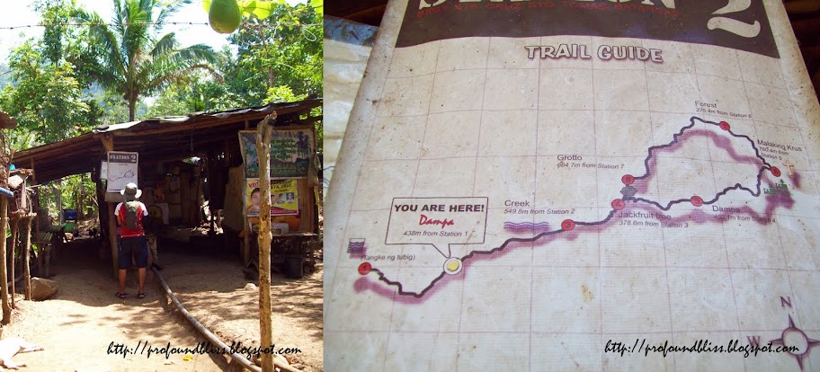
Anyway, the trail to the summit was very established even a first-time climber could have done it alone. A few meters into, you would pass by a hut (with caged monkeys, guinea pigs, etc.) with a map of the trail. The trail splits at one point but you can choose either way and end up at the summit.

We chose to go right first and passed by Mang Pirying's hut. He's quite famous for treating climbers to cups of coffee but since the hut was already full of mountaineers that time, K and I decided to just go on with the trek (and I regret passing on a photo op with Mang Pirying and having a taste of his famed homemade kapeng barako).

It was a pleasant climb; no hurrying. At 760+ MASL and a minor climb, we knew there's no reason to hurry to catch the last bus trip to Manila. But even with a slow pace, we were able to reach the peak in 1 hour and 45 minutes. 15 minutes less than the internet's maximum of 2 hours.

A group of high school students together with two male teachers were at the camp site when we got there. They said they were from a nearby school and it was part of their summer scouting training. All were friendly and K, blessed with good looks like that, was an instant crush among the girls.

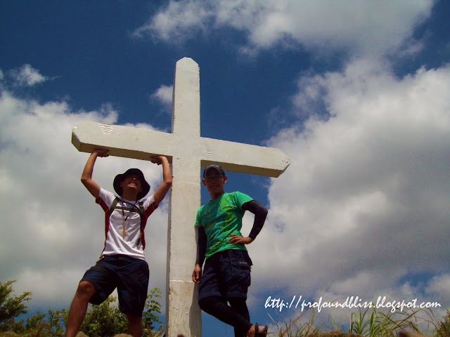
It was scorching hot at the peak it was hard to take pictures with the white cross. More than that, the mountaineers at Mang Pirying's hut caught up with us while we were at the peak. It was hard to take pics especially that the sole girl in their group would insist on joining us in pictures. She wouldn't leave the cross, really. So we decided to just go back to the camp site first to have lunch.

Manabu Peak camp site:

The peak was already clear after we had lunch so we packed up to have our photo op with the white cross. About that time, the kids were also about to leave.

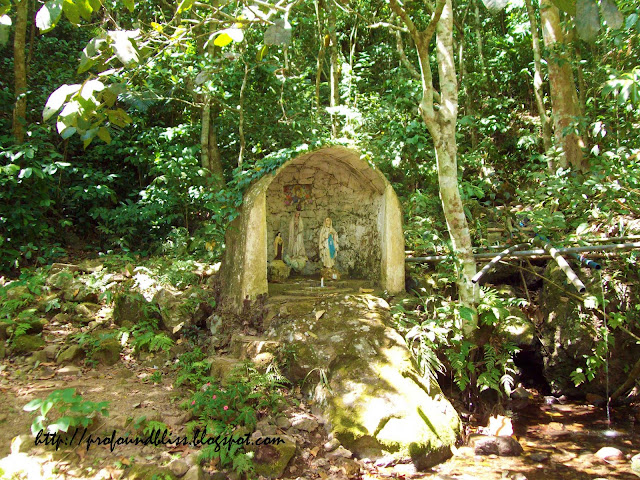
We used the other trail to go down. It was much steeper than the other trail. The grotto was also along that part where there's a water source.

The grotto area was a cool place to hang out with water and shade and benches and a big table. It was so cool that a lot of empty wine bottles were left in the area by, obviously, "mountaineers" who had so much fun they forgot to bring their trash. I couldn't have brought all those bottles with me, I would need a bigger bag than the one I was using if I wanted to.

It took us exactly 1 hour and 20 minutes to descend. That included a long stay at the grotto area. It's a really nice place for people to hang out and talk, that is, when you have the place all to yourselves.

The store owner at the jump-off kinda talked to us a little which ended with us buying Coke. She also (kinda) talked us into hiring a tricycle to take us to the bus station. It cost P150.00 and when I asked for an alternative ride, she said it was too far.

A freelance mountaineer named Jay (who's climbing that afternoon with his girlfriend) befriended us. He told us that it'd be better to just walk a few meters to the main road and ride a passenger jeep that would take us to the bus station. But when we told the store owner we changed our minds about the tricycle, she told us she has already texted the driver and already on its way. Talking about being fooled.

Anyway, Sir Jay, upon learning that I also climb freelance, got my number. He told me he'd invite me when he got an invitation to climb (networking, is that you?). We also had a story exchange on the mountains we've already climbed and one mountain he talked about with much interest was Mt. Talamitam in Nasugbu. And it immediately got my fancy.

After we washed up, the tricycle arrived. The ride was not that long for P150.00 really. We passed by the Fiesta Mall and the driver dropped us off at a familiar place near the Tanza Municipal Hall. Familiar cuz that was also where the van from Alabang dropped us off when we went to Pico de Loro.

The bus left the station at 4 PM and it was almost completely dark when we reached Alabang.

At that moment, I remembered the first time I climbed a mountain. I don't know why but I especially remembered how my legs were so aching at that time that I literally clung on the bus door's handlebar when I was going down.

The memory gave me a nostalgic feeling – that happy feeling of being on my own; of traveling alone. And I knew I had to climb solo again.

*View my Manabu Peak photoset by clicking here.

How to get to Manabu Peak (our way :D):

- ride an ordinary Lucena-bound bus and ask to be dropped off at Brgy. San Pedro in Sto. Tomas, Batangas (P57.00)
- hire a tricycle to take you to 'Sulok' in Brgy. Sta. Cruz (P250.00)

The best way to get to Manabu Peak:

- ride a Lipa-bound bus and drop off at Fiesta Mall along the Sto. Tomas-Lipa Road
- hire a tricycle to get to the jump-off in 'Sulok' in Brgy. Sta. Cruz

The Scorching Hotness of Mt. Batulao

0 comments

I've heard about Mt. Batulao even before I started climbing mountains. Words about how pleasant and easy it is to climb, and how well-frequented the mountain is by mountaineers and non-mountaineers alike who just want to have a taste of the mountain, make Mt. Batulao a very famous minor climb.

But that fact kind of made me shy away from climbing Mt. Batulao. It's very accessible; ride a Nasugbu-bound bus and ask to be dropped off at Evercrest and that's it.

I climb for the peacefulness of the mountains. I climb for serenity. Thinking about climbing a mountain with so many hikers kinda makes me think twice.

But at the back of my mind, I knew I had to climb Mt. Batulao at one point. And last March 27th, I found myself with K debating whether to climb Manabu Peak or Mt. Batulao. We both haven't been to Manabu yet and it would be an additional expense to hire a guide, while he already climbed Batulao last January with the MSOC (and I was in Mindoro when they invited me the day before they climbed so I wasn't able to join them) and he already knew the trail.

It was already 9 AM when we reached Evercrest. The breeze was cool despite the cloudless sky. We walked all the way to the jump-off which was so far from the main road. You can ride a tricycle if you like but we preferred to walk as a sort of a warm-up.

Mt. Batulao is a grassland. Good thing I learned from previous climbs not to underestimate a mountain however easy the internet claims the climb to be, and I brought stuff that I usually bring every time I climb. A pair of arm warmers is a must-bring for a Batulao climb, not because you need your arms to be warm but for protection from the sun. It's better if you'd wear a long-sleeved dri-fit, but that's not for me unless it's a really cold mountain.

Caps can shield your face from the sun but bush hats with really wide brims are much better. You wouldn't want your nape to burn. Don't let the coolness of the wind fool you. It really is hot.

For this climb, though, I used K's beige brim hat because I couldn't find mine. In exchange, I let him borrow my white and red dri-fit shirt because he couldn't find his own. LoL!

We used the new trail to climb up the summit. It wasn't that hard but it's kinda dangerous cuz you'd be walking on cliff-edges with a very high drop.

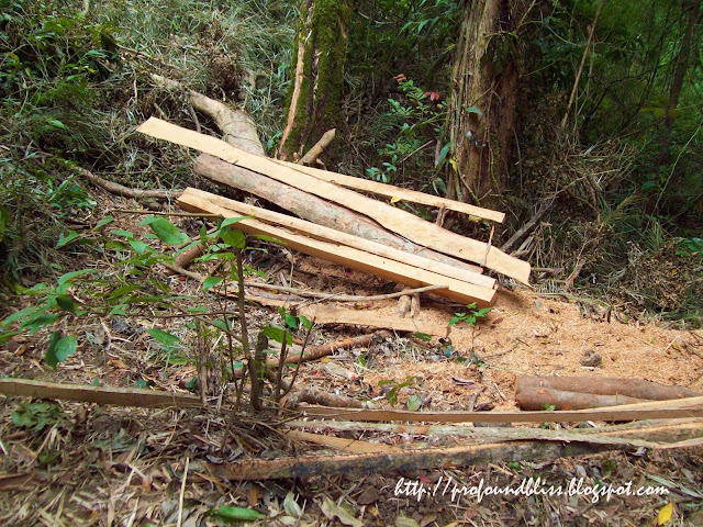
At one point (before the cliff edges), we stayed away from the usual trail by passing through a forested area to hide from the heat of the sun for a while. And that's where we found this:

Is this illegal logging, or is this logging illegal? Let's just hope it's not. But what else could that be?

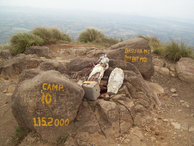
Mt. Batulao's summit is a little small with statues of the Virgin Mary lying on the ground. It's such a shame that they couldn't even find the effort to secure the statues in place. Would it cost much considering the number of hikers who pay the registration fee every day?

One of the statues was even beheaded! C'mown! I think it would be better if we take these religious statues down than leave them there like that.

Anyway, we used the old trail to go back to the jump-off. It's much, much, steeper than the new trail and had we known, we would have opted to use the old trail for the ascent.

But the thing was that even if you already paid the registration fee for using the new trail to climb up, you need to pay another registration fee of Php 20.00 per head if you chose to use the old trail for your descent. Or vice-versa.

Here's a view of the mountain from the old trail:

We stopped for a while to drink sabaw ng buko which cost Php 20.00 each. It was quite refreshing considering the scorching hotness of that day. We took that moment to rest and clean up a bit with our towels. There's a broken mirror at the buko stand and we laughed at ourselves for looking so grimy - dust and sweat and all that.

My Mt. Batulao experience could be summed up as fun. The sceneries were superb and balancing yourself so you wouldn't slide down with the powdery dry soil was a challenge. Good thing my Sandugo sandals still served me right despite its being already worn down.

We were at Evercrest by 3 PM. There's a wedding ceremony going on at the Caleruega Church that I wasn't able to take pictures. Shy din naman ako paminsan-minsan. Besides, we looked so dirty against the tuxedo and Barong Tagalog clad guests. LoL!

3 PM is still early despite the fact that we started out late. And since it's early enough to still roam around, we decided to have a late lunch at Nasugbu's town proper.

But that's another story.
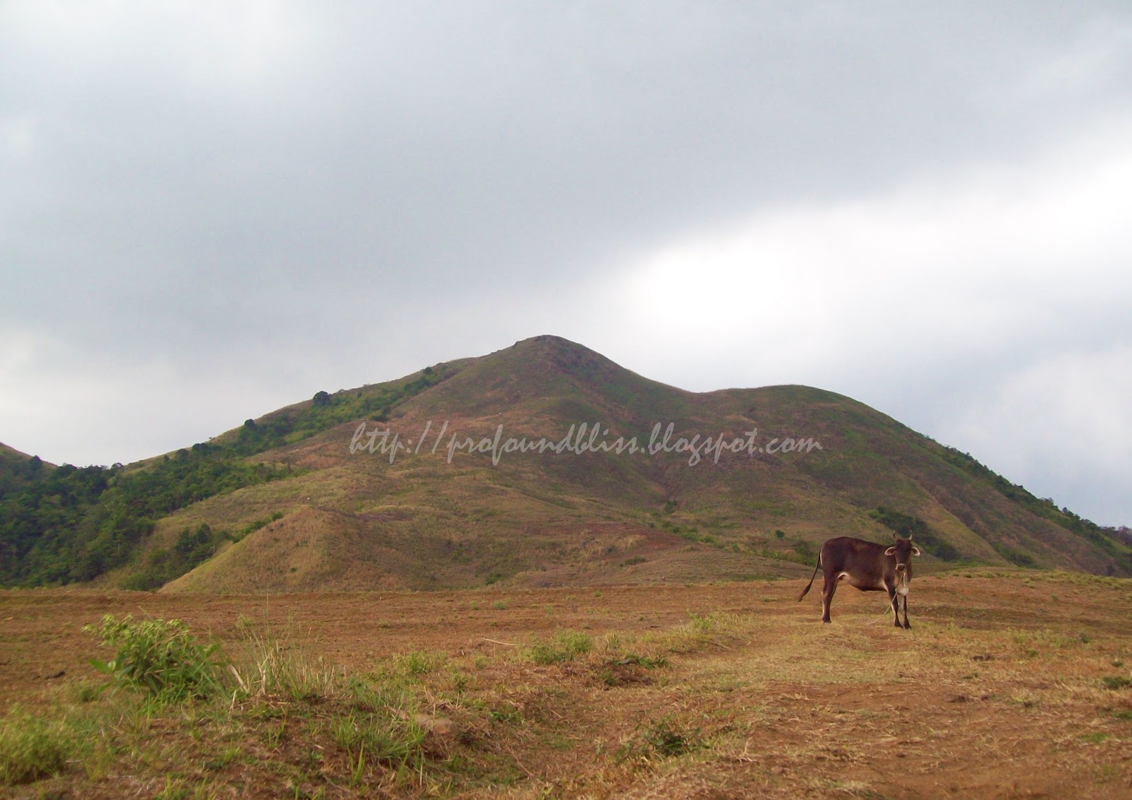
How to get to Mt. Batulao

* board a Nasugbu-bound bus
* asked to be dropped at Evercrest (P106.00 from Pasay Rotonda to Evercrest as of this writing)
* walk or ride a tricycle to the jump-off (going towards the direction of Evercrest)
* pay dayhike registration of P20.00 (registration area is way deep into the mountain; overnight fee is P30.00)
* pay another registration fee of P20.00 if you decide to use a different trail to go down (there are two trails – the new and old)
* wash up at the stores lining the Tagaytay-Nasugbu road where you dropped off (costs P20.00)
* wait for a bus back to Baclaran or Pasay (we're told the last trip passes by around 8:30 PM)

View my Mt. Batulao Facebook album by clicking here.

Related Posts with Thumbnails